Caves and shafts in Senterada
Senterada, in the Pallars Jussà, lies at the entrance to the vall Fosca, near the confluence of the Flamisell river with the Noguera Pallaresa. Its sparsely populated Pyrenean mountain territory combines woodland and pasture on a steep relief descending from the peaks to the valley floor, with high-altitude karst cavities included in the catalogue.
The catalogue includes 5 cavitats (4 coves i 1 avenc) in Senterada. Cova de la Font de Lluçà, amb 95 m de recorregut.
The surveyed length of the caves with this data ranges from 5 to 95 metres. The depth ranges from 9 to 30 metres. 2 different rock types are recorded here. You can check the full entry for location, access and, where available, photographs and survey maps. The whole set of caves on this page can also be downloaded as CSV or JSON.
County: Pallars Jussà
Rock Types
- Cova de la Font de LluçàCova de 95 metres de recorregut a Lluçà (Senterada).
- Forat dels MollonsAvenc de 30 metres de fondària a la serra de Peracalç (Senterada).
- Cova del CinglePetita cova de 30 metres de recorregut a la serra de Sant Gervàs (Senterada).
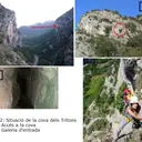
- Cova dels TritonsInteressant cova amb restes arqueològiques, Senterada.
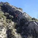
- Cova del PushokPetita cova penjada a la cinglera de l'Estret del Congost (Senterada).