Caves and shafts in Alta Ribagorça
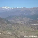
Alta Ribagorça, the least populated county in Catalonia, extends across axial high-mountain Pyrenees with the Vall de Boí as its main landmark. Altitude and isolation have historically limited the exploration of caves and potholes, and the catalog records a small but real number here.
The catalogue includes 18 cavitats (9 coves i 9 avencs) in Alta Ribagorça, concentrated in el Pont de Suert and la Vall de Boí. Forat del Graller, amb 211 m de recorregut.
The surveyed length of the caves with this data ranges from 4 to 211 metres. The depth ranges from 2 to 89 metres. 3 different rock types are recorded here. You can check the full entry for location, access and, where available, photographs and survey maps. The whole set of caves on this page can also be downloaded as CSV or JSON.
Alta Ribagorça has an area of 427 km², located mostly in el Pirineu Axial. This means an approximate density of 4.2 catalogued caves per 100 km².
Municipalities
Rock Types
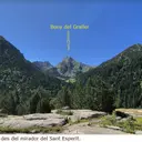
- Forat del GrallerInteressant travessia de 89 metres de desnivell a la Vall de Boí.
- Graller del PortúsAvenc de 40 metres de fondària a la serra de Sant Gervàs (Pont de Suert).
- Graller de Sant RocCavitat de 35 metres de desnivell al municipi de Pont de Suert
- Forat del MontCova de 60 metres de recorregut a la Vall de Boí.
- Forat d'IrgoPetit avenc de 24 metres de fondària a Irgo (el Pont de Suert).
- Forat de VentolàPetit avenc de 14 metres de fondària, a Ventolà (el Pont de Suert).
- Cova de FesoleretsPetita cova de 39 metres de recorregut, a Viu de Llevata (el Pont de Suert).
- Graller de les PlanellesPetit avenc de 14 m. de fondària a la zona d'Adons (Alta Ribagorça)
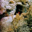
- Cova de l'AvedogaCova de 20 m de recorregut a Adons (Pont de Suert).
- Graller Lo ComúAvenc de 10 metres de fondària a Adons (El Pont de Suert).
- Forat de SarroquetaPetit avenc d'uns 10 m. de fondària vora el poblet de Sarroqueta (el Pont de Suert)
- Cova d'en BadiaBalma de 15 metres de recorregut, a Viu de Llevata (el Pont de Suert).
- Graller del Serrat del PasqualÍnfim avenc de 5 metres de fondària a la Viu de Llevata (Pont de Suert).
- Cova de la FigueraBalma de 13 metres de recorregut, a Viu de Llevata (el Pont de Suert).
- Cova del Serrat del PasqualPetita cova de 10 metres de longitud a la Viu de Llevata (Pont de Suert).
- Cova de la Roca de la CoronaÍnfima coveta d'origen clàstic a la zona d'Irgo (Alta Ribagorça)
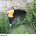
- Coves d'AdonsMinúscules covetes vora d'Adons (Alta Ribagorça)
- Cova del SardoPetita balma d'interès arqueològic a la vall de Sant Nicolau.