Caves and shafts in Ribera d'Urgellet
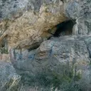
Ribera d’Urgellet, in the Alt Urgell, was formed by the grouping of several former municipalities around the river Segre, next to Organyà and its well-known gorge. The municipal area extends across a Prepirineu of steep limestone relief, with ranges and cliffs descending to the valley. This karst terrain accounts for the presence of a good number of catalogued cavities in the municipality.
4 cavitats (3 coves i 1 avenc) in Ribera d'Urgellet have been catalogued. Espluga Nº3 dels Lladres, amb 35 m de recorregut.
The surveyed length of the caves with this data ranges from 3 to 35 metres. The depth ranges from 5 to 15 metres. You can check the full entry for location, access and, where available, photographs and survey maps. The whole set of caves on this page can also be downloaded as CSV or JSON.
County: Alt Urgell
Rock Types
- Espluga Nº3 dels LladresPetita cova de 35 metres de recorregut a Ribera d'Urgellet.
- Avenc MarquèsAvenc de 14 metres de fondària a Montant de Tost (Ribera d'Urgellet).
- Espluga Nº1 dels LladresPetita cova de 16 metres de recorregut a Ribera d'Urgellet.
- Espluga Nº2 dels LladresÍnfima cova de 3,5 metres de recorregut a Ribera d'Urgellet.