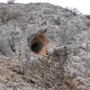
Caves and shafts in Ullà
Ullà, in the Baix Empordà, sits on the alluvial plain of the river Ter, not far from Torroella de Montgrí and the Montgrí massif. The municipal area, mostly flat and agricultural, typical of the Empordà plain, contrasts with the nearby limestone relief, and the catalogue of cavities reflects this situation of low-lying land by the river.
There are 2 cavitats catalogued in Ullà. Cau del Duc d'Ullà, amb 15 m de recorregut.
The surveyed length of the caves with this data ranges from 5 to 15 metres. The depth on record is 4 metres. Each entry includes exact location, coordinates and, where available, photographs and survey maps, with a downloadable GPX track. The whole list on this page can also be exported as CSV or JSON.
County: Baix Empordà