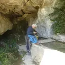
Caves and shafts in les Valls d'Aguilar
Les Valls d’Aguilar, in the Alt Urgell, was formed in 1972 by the merger of several small municipalities and today brings together thirteen rural villages (Argestues, Bellpui, Berén, Biscarbó, Castellàs, Espaén, Tahús, Trejuvell and others). This very sparsely populated mountain territory retains a limestone relief that generates a notable number of catalogued cavities.
43 cavitats (33 coves i 10 avencs) in les Valls d'Aguilar are part of the catalogue. Cova de la Barra, amb 163 m de recorregut.
The surveyed length of the caves with this data ranges from 4 to 163 metres. The depth ranges from 1 to 36 metres. 2 different rock types are recorded here. Each entry includes exact location, coordinates and, where available, photographs and survey maps, with a downloadable GPX track. The whole list on this page can also be exported as CSV or JSON.
County: Alt Urgell
Rock Types
les Valls d'Aguilar council website ↗
- Coves de l'Escala i NS-19Cova de 144 metres de recorregut i 36 de desnivell a Les Valls d'Aguilar
- Cova de la BarraCova de 163 metres de recorregut a Les Valls d'Aguilar
- Pou de les GrallesAvenc de 35 metres de fondària a Les Valls d'Aguilar
- Cova de Boli ErminiCova de 65 metres de recorregut a Les Valls d'Aguilar
- Avenc T-7Avenc de 22 metres de fondària a Les Valls d'Aguilar
- Avenc T-4Avenc de 21 metres de fondària a Les Valls d'Aguilar
- Forat de l'InfernAvenc de 16 metres de fondària a Les Valls d'Aguilar
- Sumider de TaúsAvenc de 19 metres a la serra de Prada, Les Valls d'Aguilar
- Forat Negre de MiravallCova de 59 metres de recorregut a Les Valls d'Aguilar
- Cova CA-6Cova de 42 metres de recorregut a Les Valls d'Aguilar
- Cova PalomeraCova de 42 metres de recorregut a Les Valls d'Aguilar
- Avenc del Pla FornesaPetit avenc de 16 metres de fondària a Les Valls d'Aguilar
- Cova Superior de la BarraCova de 28 metres de recorregut a Les Valls d'Aguilar
- Avenc del MortAvenc de 15 metres de fondària a Les Valls d'Aguilar
- Cova NS-21Cova de 16 metres de recorregut a Les Valls d'Aguilar
- Avenc T-8Petit avenc de 9 metres a la serra de Prada, Les Valls d'Aguilar
- Cova NS-3Cova de 17 metres de recorregut a Les Valls d'Aguilar
- Cova del PontPetita cova de 19 metres de recorregut a Les Valls d'Aguilar
- Cova de la Font de MiravallCova de 22 metres de recorregut a Les Valls d'Aguilar
- Cova NS-1Cova de 15 metres de recorregut a Les Valls d'Aguilar
- Cova NS-2Cova de 14 metres de recorregut a Les Valls d'Aguilar
- Avenc de la LlosaÍnfim avenc de 5'7 metres de fondària a Les Valls d'Aguilar
- Cova NS-14Cova de 14 metres de recorregut a Les Valls d'Aguilar
- Cova T-13Cova de 10 metres a Les Valls d'Aguilar
- Cova Inferior de la BarraCova de 18 metres de recorregut a Les Valls d'Aguilar
- Avenc T-3Petit avenc de 7 metres de fondària a Les Valls d'Aguilar
- Cova NS-16Cova de 8 metres de recorregut a Les Valls d'Aguilar
- Cova Nº 1 del GrèvolCova de 9 metres de recorregut a Les Valls d'Aguilar
- Espluga de CastellsGran Balma de 33x13 metres a Les Valls d'Aguilar
- Espluga de MiravallCova de 13 metres de recorregut a Les Valls d'Aguilar
- CA-5-1Cova de 9 metres de recorregut a Les Valls d'Aguilar
- Cova T-9.APetita cova d'onze metres a Les Valls d'Aguilar
- Cova NS-9-BCova de 8 metres de recorregut a Les Valls d'Aguilar
- Cova T-9.BPetita cova de 10 metres a Les Valls d'Aguilar
- Cova Nº 2 del GrèvolCova de 6 metres de recorregut a Les Valls d'Aguilar
- Cova NS-23Cova de 8 metres de recorregut a Les Valls d'Aguilar
- Cova NS-9-ACova de 9 metres de recorregut a Les Valls d'Aguilar
- Cova del RoserPetita cova de 9 metres de recorregut a Les Valls d'Aguilar
- CA-5-2Cova de 6 metres de recorregut a Les Valls d'Aguilar
- Cova T-9.CPetita cova de 8 metres a Les Valls d'Aguilar
- Cova del Pi GrosPetita cova de 7 metres de recorregut a Les Valls d'Aguilar
- Cova NS-10Cova de 4 metres de recorregut a Les Valls d'Aguilar
- Cova NS-8Cova de 5 metres de recorregut a Les Valls d'Aguilar