Caves and shafts in Lluçanès
Lluçanès, like Moianès, is one of the newest and smallest counties in Catalonia, situated on a plateau between Berguedà, Osona and Bages. The number of cataloged caves and potholes is, accordingly, modest, but reflects the same calcareous character it shares with the neighboring counties.
The catalogue includes 28 cavitats in Lluçanès, concentrated in Lluçà, Prats de Lluçanès and Sant Martí d'Albars. La Tronassa de la Tor, amb 50 m de recorregut.
The surveyed length of the caves with this data ranges from 4 to 50 metres. The depth ranges from 1 to 6 metres. 2 different rock types are recorded here. You can check the full entry for location, access and, where available, photographs and survey maps. The whole set of caves on this page can also be downloaded as CSV or JSON.
Lluçanès has an area of 227 km², located mostly in la Depressió Central. This means an approximate density of 12.3 catalogued caves per 100 km².
Municipalities
Rock Types
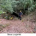
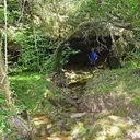
- La Tronassa de la TorCuriós fenomen subterrani d'uns 50 m. de recorregut entre el Lluçanès i el Berguedà.
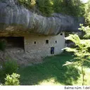
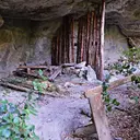
- Balma Nº1 dels RaconsGran balma amb un antic habitatge dins, a Lluçà
- Cova del LladrePetita cova de 20 m a Lluçà (Lluçanès)
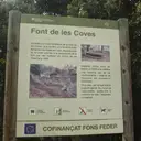
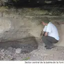
- Balma Nº1 de la Font de les CovesConeguda balma a Lluçà, habilitada com àrea recreativa.
- Balmes de la Font dels BousBalmes superposades a Lluçà.
- Balma Nº2 dels RaconsBalma allargada i omplerta en bona part per grans blocs, a Lluçà.
- Balma de la Font de Cal BlancBalma amb petita font a Sant Martí d'Albars (Lluçanès)
- Balma del Pont de les HeuresBalma a la riera de Merlès, Lluçà (Lluçanès)
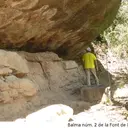
- Balma Nº3 de la Font de les CovesBalma de poca importància a Lluçà
- Balma dels GitanosAllargada balma a Sant Martí d'Albars (Lluçanès)
- Balma de PaüsaBalma de grans dimensions a Alpens (Lluçanès)
- Balma de la FigueraAmagada balma al torrent de Sant Joan (Lluçà)
- Balma del PratBalma de grans dimensions a Lluçà (Lluçanès)
- Balma de la VallGran balma a Alpens (Lluçanès)
- La TronassetaPetita balma a Lluçà (Lluçanès)
- Balma del Coll TriadorPetita balma a Perafita (Lluçanès)
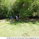
- Balma de Cal CoixPopular i coneguda balma a Lluçà (Lluçanès)
- Balmes del GaretConjunt de dues balmes vora Lluçà (Lluçanès)
- Balma de l'EstradaConeguda balma a Lluçà (Lluçanès)
- Balma de la Font GuilleraAllargada balma a Lluçà/Prats de Lluçanès
- Balma de la Font de la TeulaPetita balma amb font interior a Lluçà
- Balma dels ConillsPetita balma a Lluçà (Lluçanès)
- Balma del Molí del CingleDoble balma sota saltant a Prats de Lluçanès
- Balma Nº2 de la Font de les CovesBalma de poca importància a Lluçà
- Balma de la Font del ClotetPetita balma que ressegueix un gorg a Prats de Lluçanès
- Bauma dels LladresModesta balma al Lluçanès
- Balma de la CasanovaÀmplia balma a Olost (Lluçanès)
- Balma del GrauPetita balma de només 4 m. de fons a Lluçà