Caves and shafts in Camarasa
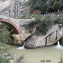
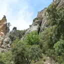
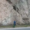
Camarasa, at the confluence of the Segre and the Noguera Pallaresa, is known above all for its reservoir — built in the 1920s to generate electricity — which stretches 20 km toward Montsec and covers 624 hectares. The municipality, also made up of the settlement of Sant Llorenç de Montgai, combines this river landscape with the limestone relief of the nearby Montsec, which generates a notable karst here.
55 cavitats (37 coves i 18 avencs) in Camarasa have been catalogued. Forat de l'Or, amb 2213 m de recorregut.
The surveyed length of the caves with this data ranges from 5 to 2213 metres. The depth ranges from 1 to 103 metres. 5 different rock types are recorded here. You can check the full entry for location, access and, where available, photographs and survey maps. The whole set of caves on this page can also be downloaded as CSV or JSON.
County: Noguera
Rock Types
- Forat de l'OrImportant surgència de 2.213 m. de recorregut al congost de Terradets (Camarasa).
- Forat del CoscollAvenc de 103 metres de desnivell a Camarasa
- Cova de l'EscaletaCova de 265 metres de recorregut al municipi de Camarasa.
- Cova del TabacCova de 198 metres de recorregut al municipi de Camarasa.
- Avenc l'EstretaAvenc de 51 metres de fondària a Camarasa
- Forat de l'Obaga de la MaçanaCavitat de 45 metres de desnivell a Camarasa
- Avenc la SerpAvenc de 38 metres a Camarasa.
- Avenc de la DolinaAvenc de 28 metres de fondària a Camarasa
- Cova de Sant JordiCavitat de 23 m. de desnivell i 93 m. de recorregut al municipi de Camarasa.
- Cova de la Pala AltaCova de 112 metres de recorregut a Camarasa
- Cova B de la Canal de MigjornCova de 90 metres de recorregut al Montsec de Rúbies (Camarasa)
- Forat de la CabeçolaAvenc de 24 metres de fondària a Camarasa.
- Forat de la ConvocatòriaAvenc de 32 metres de fondària a Camarasa.
- Cova de l'AiguaCova de 42 metres de recorregut a Camarasa
- Avenc de la FigueraAvenc de 18 metres de fondària a Camarasa.
- Avenc del TabacAvenc de 25 metres de desnivell al municipi de Camarasa.
- Cova d'en MaranyaPetita cova de 37 metres de recorregut a Camarasa
- Avenc del GellPetit avenc de 15 metres de fondària a la zona de l'Encantada (Camarasa).
- Esquerdes de MonteróPetites esquerdes de 50 metres de recorregut a Monteró, (Camarasa).
- Avenc de la RendiscleraCuriós avenc de col·lapse a Camarasa.
- Cova del Pas de l'OscaCova de 41 metres de recorregut a la cara S del Montsec de Rúbies.
- Cova del PollancreCova de 40 metres de recorregut al congost de Terradets. (Camarasa).
- Avenc del MiradorAvenc de 15 metres de desnivell al Montsec de Rúbies (Camarasa)
- Cova de MontaspreCova sota les ruïnes de l'església de Sant Miquel de Montaspre a l'Ametlla de Montsec (Camarasa).
- Cova GranCova de 27 metres de recorregut a Camarasa
- Forat del TúnelGran depressió oberta en guixos.
- Avenc de Sant JordiCavitat de 13 metres de fondària al municipi de Camarasa.
- Finestra dels PelatsCova de 30 metres de recorregut a la Serra del Mont-roig, Camarasa.
- Esquerda Nova de la CarreteraCova de 24 metres de recorregut al congost de Terradets (Camarasa).
- Cova C de la Canal de MigjornCova de 27 metres de recorregut al Montsec de Rúbies (Camarasa)
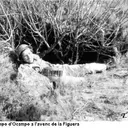
- Avenc OcampoAvenc de 12 metres de desnivell al municipi de Camarasa
- Avenc de les AranyesPetit avenc de 12 metres de fondària a Monteró, (Camarasa).
- Cova de l'Il.luminatPetita cova de 25 metres de recorregut al municipi de Camarasa.
- Avenc de la BanyaAvenc de 12 metres de fondària a la Coma de Gelis (Camarasa)
- Cova de la FigueraCova de 30 metres de recorregut al municipi de Camarasa.
- Forat del Cap de MortCova de 30 metres de recorregut a la Serra de Monteró, Camarasa.
- Cova de Sant OïsmeCova de 20 metres de recorregut a La Baronia de Sant Oïsme (Camarasa).
- Cova de l'AiguaPetita cova d'aproximadament 25 metres de recorregut a Camarasa
- Cova del MalaltCova de 15 metres de recorregut a la Coma de Gelis (Camarasa)
- Cova del SostreCova de 20 metres de recorregut a Monteró, (Camarasa).
- Forat de l'EncantadaPetit avenc de 7 metres de fondària a la zona de l'Encantada (Camarasa).
- Bauma de l'OrellaBalma de 13 metres de recorregut al congost de Terradets. (Camarasa).
- Cova de l'EstacaCova de 17 metres de recorregut a Camarasa
- Cova de l'ArenaÍnfima cova de 13 metres a Camarasa
- Cova de l'ArcadaÍnfima cova de 12 metres de recorregut al municipi de Camarasa.
- Forat Bufador de Sant JordiÍnfima cavitat de 4 metres de fondària a Camarasa
- Els FreixesConjunt de petites coves que en total sumen 27 metres a Camarasa.
- Cova del PeladetPetita cova a prop de la Portella Blanca.
- Cova Petita del TabacÍnfima cova de 12 metres de recorregut al municipi de Camarasa.
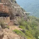
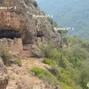
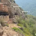
- Balma Nº1 de la MaçanaBalma obrada al barranc de la Figuereta, la Maçana (Camarasa).
- Balma Nº2 de la MaçanaBalma obrada al barranc de la Figuereta, la Maçana (Camarasa).
- Balma Nº3 de la MaçanaBalma obrada al barranc de la Figuereta, la Maçana (Camarasa).
- Cova de la Figuera PetitaCova de 6 metres de recorregut al municipi de Camarasa.
- Cova dels GraonsPetita cova al cingle del Puig de Sant Jordi (Camarasa)
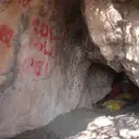
- Balma del PantàPetita balma amb pintures rupestres a Camarasa.