Caves and shafts in Roses
Roses, in the Alt Empordà, opens onto the gulf that bears its name, with a coastline that climbs towards the rocky foothills of the cap de Creus, the easternmost tip of the Pyrenees where they meet the sea. The town, of ancient origin and with a notable Renaissance citadel, combines beaches with a municipal area that climbs towards a granite and rugged relief, where cavities typical of this coastal massif have been catalogued.
There are 8 cavitats catalogued in Roses. Cau del Lliri, amb 460 m de recorregut.
The surveyed length of the caves with this data ranges from 3 to 460 metres. The depth ranges from 1 to 73 metres. 3 different rock types are recorded here. Each entry includes exact location, coordinates and, where available, photographs and survey maps, with a downloadable GPX track. The whole list on this page can also be exported as CSV or JSON.
County: Alt Empordà
Rock Types
- Cau del LliriCova de 460 metres de recorregut i 73 metres de desnivell a Roses
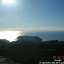
- Cova del TraireCova de 54 metres de recorregut al Cap Norfeu (Roses).
- Cova de les ErmitesCova de 33 metres de recorregut a Roses
- Cova de l'Aigua de MalaterraCova de 25 metres de recorregut a Roses.
- Cau de les GuillesPetita concavitat entre blocs a l'E de Roses
- Cova Nº 1 del Puig de la MalaterraBalma de 9 metres de recorregut a Roses
- Cova Nº 2 del Puig de la MalaterraCova de 6 metres de recorregut a Roses
- Cova de CortalàsPetita cova d'interès arqueològic a Roses.