Caves and shafts in Alt Empordà
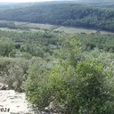
Alt Empordà has its most significant karst relief in the massís de l’Albera, on the border with France, while the nearby Cap de Creus —of granitic and schistose origin— brings a rather different geological contrast. The county’s cataloged caves and potholes reflect this diversity between soluble rock and practically insoluble rock within the same territory.
There are 95 cavitats (59 coves i 36 avencs) catalogued in Alt Empordà, mostly in Albanyà, l'Escala and Roses. Cau del Lliri, amb 460 m de recorregut.
The surveyed length of the caves with this data ranges from 3 to 460 metres. The depth ranges from 1 to 73 metres. 7 different rock types are recorded here. Each entry includes exact location, coordinates and, where available, photographs and survey maps, with a downloadable GPX track. The whole list on this page can also be exported as CSV or JSON.
Alt Empordà has an area of 1358 km², located mostly in el Prepirineu. This means an approximate density of 7.0 catalogued caves per 100 km².
Municipalities
Rock Types
- Cau del LliriCova de 460 metres de recorregut i 73 metres de desnivell a Roses
- Forat del GinebretAvenc de 55 metres de fondària a la Tossa d'Espinau (Albanyà).
- Avenc de la CalmaAvenc de 52 metres de fondària a Llers, Alt Empordà.
- Forats de la Tossa d'Espinau Nº1-3Avenc de 22 metres de fondària a la Tossa d'Espinau (Albanyà).
- Forat del Pla de MontosaAvenc de 25 metres de fondària a Albanyà.
- Cova de la XinxaTúnel submarí amb diverses ramificacions a l'Escala.
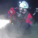
- Cova de TrencabraçosCova submarina de 90 metres de recorregut a l'Escala.
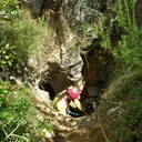
- Avenc de Can VilàBonic avenc de 26 m. de fondària a Terrades (Alt Empordà)
- Pou del FauAvenc de 30 metres de fondària a la serra de Bac Grillera (Maçanet de Cabrenys).
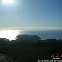
- Cova del TraireCova de 54 metres de recorregut al Cap Norfeu (Roses).
- Forat del RoquissarPetit avenc de 21 metres de fondària a la serra de les Corones (Albanyà).
- Forat de la Tossa d'Espinau Nº6Avenc de 26 metres de fondària a la Tossa d'Espinau (Albanyà).
- Avenc del BallóAvenc de 23 metres de desnivell a Maçanet de Cabrenys.
- Tuta de la PólvoraInteressant cova amb restes del neolític, té un recorregut de 58 metres, situada al municipi d'Albanyà.
- Forat d'en MetAvenc de 27 metres de desnivell, a l'Alta Garrotxa, Albanyà.
- Bora MajorConeguda cova d'uns 45 m. de recorregut a Terrades (Alt Empordà)
- Cau del CiriAvenc de 12 metres de fondària a Sant Llorenç de la Muga.
- Bauma de TaleixàInteressant avenc de 18 m. de fondària a Terrades (Alt Empordà)
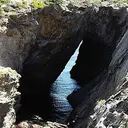
- Cova de s'InfernConegudíssima cova marina situada al Cap de Creus (Cadaqués)
- Cova del Bau de TrencabraçosCova submarina de 53 m de recorregut a l'Escala
- Tuta de les CorominesPetita cova de 51 metres de recorregut a l'Alta Garrotxa (Albanyà).
- Cova TassanaCova de 61 metres de recorregut a Cadaqués.
- Avenc del Boquerol d'en VidalAvenc inèdit d'uns 20 o 25 m de fondària a la Garriga d'Empordà (Vilanant)
- Cova del Mirador del RomaníCova submarina d'uns 50 metres de recorregut a l'Escala.
- Forat de la Baga del Ginebret 9Avenc de 19 metres de fondària al Pla dels Estanys (Albanyà).
- Cova Submarina de la Punta GrossaCova submarina d'uns 40 metres de recorregut a l'Escala.
- Forat de la Tossa d'Espinau Nº4Avenc de 6 metres de fondària a la Tossa d'Espinau (Albanyà).
- Cova de la Finestra del RomaníCova submarina d'uns 40 metres de recorregut a l'Escala.
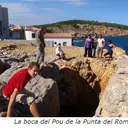
- Pou del RomaníPetit avenc de 12 m. de fondària a l'Escala (Alt Empordà)
- Cova de la CaulaCova de 34 metres de recorregut a Les Escaules (Boadella i les Escaules).
- Tuta de l'ErmedàPetita cova de 30 metres de recorregut a l'Alta Garrotxa (Albanyà).
- Bauma de BruguerPetita cova de 35 m. de recorregut a Terrades (Alt Empordà)
- Cova de la Punta GrossaCova marina de 40 m. de recorregut a l'Escala (Alt Empordà)
- Mina del PontPetita cova artificial de 42 metres de recorregut a Albanyà.
- Cova del Pla de PrincipiCova de 38 metres de recorregut a l'Alta Garrotxa (Albanyà).
- Forat de la Tossa d'Espinau Nº5Avenc de 9 metres de fondària a la Tossa d'Espinau (Albanyà).
- Forat del Pla de la GuàrdiaAvenc de 9 metres de fondària al Pla de la Guàrdia (Albanyà).
- Avenc de Can Pau CalóPetit avenc de 12 m. de fondària a Terrades (Alt Empordà)
- Cova de les ErmitesCova de 33 metres de recorregut a Roses
- Cova del MaquiPetita cova de 23 metres de recorregut, a l'Alta Garrotxa, Albanyà.
- Túnel Submarí del RomaníPetit túnel submarí de 25 m. De recorregut a l'Escala (Alt Empordà)
- Forat del Puig CaçadorPetit avenc amb 11 metres de fondària a la serra de les Corones (Albanyà).
- Forat del Còrrec Nº1Avenc de 13 metres de fondària a la Baga del Ginebret (Albanyà).
- Cova d'en MallorcaCova de 30 metres de recorregut que puntualment actua de “trop-plein” a Albanyà.
- Cova de la Columna de l'EstaquetaCova submarina de 30 metres de recorregut a la zona de la Punta de Montgó (l'Escala).
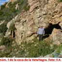
- Cova de la Veta NegraCavitat artificial de 28 m. de recorregut a Palau-saverdera (Alt Empordà)
- Forat d'en XaviPetit avenc de d'11 metres de fondària a Lliurona (Albanyà).
- Forat del Còrrec Nº2Avenc d'11 metres de fondària a la Baga del Ginebret (Albanyà).
- Forat de la Font del Bac dels RabadansAvenc d'11 m. de fondària al N. del Puig Bassegoda (Alta Garrotxa)
- Cova dels Encantats de la MassanellaInteressant cova de 26 m de recorregut a l'Alta Garrotxa
- Cova de l'Aigua de MalaterraCova de 25 metres de recorregut a Roses.
- Cova Gran de Roca PastoraPetita cova de 15 metres de recorregut a Sous, (Albanyà).
- Cova de les ArcadesPetita cova aprofitada com a magatzem a l'Alta Garrotxa
- Bauma d'en NoguerEspectacular cova de tant sols 22 metres de recorregut a l'Alta Garrotxa (Albanyà).
- Cova de la TorreCova de 23 metres de recorregut a Sant Llorenç de la Muga.
- Forat del Pla de la TombaPetit avenc de 9 metres de fondària a la serra de les Corones (Albanyà).
- Forat del GrèvolAvenc de 10 metres de fondària a la Tossa d'Espinau (Albanyà).
- Forat del Pla del ViPetit avenc de 5 metres de fondària a la serra de les Corones (Albanyà).
- Tuta del SenglarPetita cova de 15 metres un recorregut, a Albanyà.
- Forat de la Font del CaritgPetit avenc de 8 metres de fondària a Lliurona (Albanyà).
- Túnel Submarí de les CigalesCova submarina a l'Escala
- Cau de les GuillesPetita concavitat entre blocs a l'E de Roses
- Cova d'en XocolataCova marina d'uns 20 m. de llargada a la costa de Colera
- Cova ForadadaTúnel marí d'uns 20 m. de llargada a la línia fronterera franco-espanyola.
- Cova d'en XamuixaCova marina d'uns 20 m. de recorregut a Portbou
- Tuta de l'EspígolPetita cova de 15 metres de recorregut a l'Alta Garrotxa (Albanyà).
- Avenc Petit d'en PataPetit avenc de 8 metres de fondària a Maçanet de Cabrenys.
- Forat de la Baga del Ginebret 10Avenc de 4 metres de fondària al Pla dels Estanys (Albanyà).
- Forat del CaritgPetit avenc de 6 metres de fondària a Lliurona (Albanyà).
- Cova U E (1 E)Petita cova de 16 metres de recorregut als cingles de Roca Pastora (Albanyà).
- Forat de la Baga del Ginebret 8Avenc de 4 metres de fondària al Pla dels Estanys (Albanyà).
- Cova d'en MassotPetita cova de 15 metres de recorregut a l'Alta Garrotxa.(Albanyà)
- Cova de les LloredesPetita cova de 13 m. de recorregut al SO de Lliurona (Albanyà).
- Cova dels EncantatsPetita cova de 8 metres de recorregut als cingles de Roca Pastora (Albanyà).
- Forat de la Tossa d'Espinau Nº2Avenc de 4 metres de fondària a la Tossa d'Espinau (Albanyà).
- Forat de la Baga del Ginebret 11Avenc de 4 metres de fondària al Pla dels Estanys (Albanyà).
- Cova dels EncantatsCova de 10 metres de recorregut al Port de la Selva.
- Cova del Bou MaríPetita cova marina a Portbou
- Cova del PirataPetita cova marina a Portbou
- Cova de les RatesCova al litoral de Portbou
- Cova Tres E (3 E)Petita cova de 9 metres de recorregut als cingles de Roca Pastora (Albanyà).
- Cova Submarina d'Illa MateuaPetit túnel submarí de 9 m. de llarg a l'Escala
- Cova Nº 1 del Puig de la MalaterraBalma de 9 metres de recorregut a Roses
- Cova Dos E (2 E)Petita cova de 7 metres de recorregut als cingles de Roca Pastora (Albanyà).
- Les CavorquesConjunt de petites coves desenvolupades en sorres, en el Port de la Selva.
- Cova del TorrellóCova de 7 metres de recorregut al Port de la Selva.
- Forat de la Tossa d'Espinau Nº7Ínfim avenc de 3 metres de fondària a la Tossa d'Espinau (Albanyà).
- Cova Petita de Roca PastoraPetita cova de menys de 5 metres de recorregut a Sous, (Albanyà).
- Corral de l'AbatGran balma situada en el cingle de Roca Pastora, Albanyà.
- Cavorca CristinaPetita cova en travertins a les Escaules.
- Cova de les Tres CreusPetita cova en travertins a les Escaules.
- Cova Nº 2 del Puig de la MalaterraCova de 6 metres de recorregut a Roses
- Cova de la PortaCova sepulcral de 5 metres de recorregut al Port de la Selva.
- Cau PetitMinúscula coveta de 3 m. a Terrades (Alt Empordà)
- Cova de CortalàsPetita cova d'interès arqueològic a Roses.