Caves and shafts in Alt Segre
Alt Segre designates the upper valley of the Segre river and the ranges surrounding it, straddling Cerdanya, Alt Urgell and Berguedà, in the heart of the Prepyrenees. The limestone outcrops of this mid-to-high mountain zone have given rise to a high number of cataloged cavities, in a territory that combines river valleys with ranges close to 2,000 meters.
There are 111 cavitats (92 coves i 19 avencs) catalogued in Alt Segre, mostly in Bellver de Cerdanya, Urús and Isòvol. Cova de la Fou de Bor, amb 4246 m de recorregut.
The surveyed length of the caves with this data ranges from 3 to 4246 metres. The depth ranges from 1 to 206 metres. Each entry includes exact location, coordinates and, where available, photographs and survey maps, with a downloadable GPX track. The whole list on this page can also be exported as CSV or JSON.
Counties: Alt Urgell, Berguedà, Cerdanya
Rock Types
- Limestone111
- Cova de la Fou de BorHistòric i important sistema subterrani de més 4000 m. de recorregut a Bor (la Cerdanya)
- Avenc de la Cabana d'en GarrabaAvenc de 62 metres de fondària a Pont de Bar.
- Cova d'AnesInteressant cova de 360 m. de recorregut a Prullans (la Cerdanya)
- Cova de les EncantadesCova de 228 m. de recorregut a Cava (Alt Urgell), i a prop de Toloriu.
- Cova Gran d'OlopteInteressant cova de 232 m. de recorregut prop d'Olopte (Isòvol).
- Coves de la QueraConjunt de dues coves que sumen un recorregut de gairebé 200 m. a l'Alt Urgell.
- Cova de CarradonCova de 156 metres de recorregut a Alàs i Cerc (Alt Segre).
- Forat de les GrallesAvenc de 54 metres de fondària a Bellver de Cerdanya.
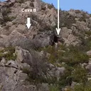
- Cova B d'OlopteCova de 134 m. de recorregut prop d'Olopte (Isòvol).
- Forat de l'EsclopInteressant cavitat als cingles de la Vall d'Ingla (Bellver de Cerdanya)
- Balma de SegalarsGran balma propera al refugi del Serrat de les Esposes (Riu de Cerdanya)
- Cova de SantufaCova de 50 m de recorregut al torrent de Fornàs (Aristot, el Pont de Bar)
- Cova dels Al.luvionsCova d'uns 60 m. de recorregut a Isòvol (la Cerdanya)
- Tuta de VimaAvenc de 28 metres de fondària a Cava (Alt Urgell)
- Cova Intermèdia de la Roca d'UrúsLa cova de més desenvolupament de les situades al Solà de la Roca d'Urús (Cerdanya)
- Cova Penjada del Grau d'InglaCova de 42 m. de recorregut a la vall d'Ingla (Cerdanya)
- Avenc-Balma del Serrat de les EsposesEspectacular balma vora el refugi del Serrat de les Esposes (Riu de Cerdanya)
- Avenc del PastorAvenc de 22 metres de fondària a Bellver de Cerdanya.
- Avenc VeliAvenc de 19 metres de fondària a Bellver de Cerdanya
- Forat del Collet de NasPetit avenc de 13 m. de desnivell (-10; +3) a Bellver de Cerdanya
- Cova d'en ManentPetita cova d'uns 40 m. de recorregut al Tossal d'Isòvol (la Cerdanya)
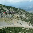
- Avenc Penjat de Coma OriolaAvenc de 19 m. de fondària a la zona de Coma Oriola (la Masella, Cerdanya)
- Avenc dels MurgolairesAvenc de 16 m de fondària a la vall d'Ingla (Cerdanya)
- Cova del SaücCova de 26 m. de recorregut al torrent del Saüc (Urús, Cerdanya)
- Forat de la Balma del FeBalma de grans dimensions prop d'Urús (Cerdanya)
- Cova Gran d'InglaPetita cova de 39 m. de recorregut a la vall d'Ingla (Cerdanya)
- Cova Gran del Grau de l'ÓsPetita cova al barranc del Grau de l'Ós (Riu de Cerdanya)
- Tuta de l'AmbretCova d'uns 30 m. de recorregut vora el sistema de la Fou de Bor
- Tuta de les EncantadesAvenc d'uns 15 m. de fondària a l'Estret de Bastanist (Cerdanya)
- Cova Remuntant de la BretxaCova ascendent de 21 m. de recorregut a la Coma Oriola (la Masella, Cerdanya)
- Esquerda SG-2Petita cavitat tectònica al Serrat Gran (Bagà)
- Forats del Vent de RidolainaConjunt de tres petites esquerdes a la part alta del Ridolaina (Cerdanya)
- Túnel de Vent d'InglaPetit túnel a la Vall d'Ingla (Bellver de Cerdanya)
- Esquerda de la Bauma PetitaEsquerda de poc més d'11 m. de desnivell a la zona de la Coma Oriola (la Masella, Cerdanya)
- Cova del Pont de RocaPetita cova descendent a la zona de Coma Oriola (la Masella, Cerdanya)
- Avenc de Coma OriolaAvenc de 10 m. de fondària a la zona de la Coma Oriola (la Masella, Cerdanya)
- Avenc del NiuPetit avenc de 9 metres de fondària a Riu de Cerdanya.
- Cova de l'EspinosaCova d'uns 21 metres de recorregut a Prullans.
- Avenc Petit d'AnesPetit avenc de 9 metres de fondària a Prullans.
- Cova de l'ÓsPetita cova de 14 metres de recorregut a Alp.
- Cau de l'EsquerdaAlta esquerda de poca importància a la zona de Coma Oriola (la Masella, Cerdanya)
- Cova Superior del Grau d'InglaPetita cova de 20 m. de recorregut a la vall d'Ingla (Cerdanya)
- Esquerda de la Canal d'UrúsEstreta esquerda sobre el Canal d'Urús (Cerdanya)
- Cova del RoserPetita cova de 18 m. de recorregut a la vall d'Ingla (Cerdanya)
- Cova Alta de PrullansPetita cova a l'E de Prullans (Cerdanya) Tipus: Cova
- Coveta Sota el Canal d'UrúsPetita cova al peu del Solà de la Roca d'Urús (Cerdanya)
- Túnel del Torrent de FontfredaPetit túnel a la Vall d'Ingla (Cerdanya)
- Cova dels BoixosPetita cova de 14 m. de recorregut a la vall d'Ingla (Cerdanya)
- Cova de les EscaldesPetita cova de 14 metres de recorregut a Prullans.
- Cova E d'OloptePetita cova de 15 m. de recorregut prop d'Olopte (Isòvol).
- Forats d'ArdòvolCova de 10 metres de recorregut a Ardòvol (Prullans).
- Xemeneia Lateral del Grau de l'ÓsPetita cavitat ascendent al torrent del Grau de l'Ós (Riu de Cerdanya)
- Cova d'IsòvolPetita cova inèdita a Isòvol (la Cerdanya)
- Baumes Gran i Petita de Coma PregonaConjunt de dues balmes a Coma Pregona (la Masella, Alp)
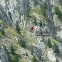
- Avenc de les PedrusquesPetit avenc de 8 m. de fondària a la zona de Coma Oriola (la Masella, Cerdanya)
- Cova G d'OloptePetita cova de 13 m. de recorregut prop d'Olopte (Isòvol).
- Cova C-3 de les EscaldesPetita cova sobre la font de les Escaldes (Prullans)
- Cova Inferior del Grau d'InglaPetita cova de 15 m. de recorregut a la vall d'Ingla (Cerdanya)
- Cova Roja de la FallaPetita cova a Coma Pregona (la Masella, Alp)
- Tuta PetitaPetita cova adjacent a la Tuta Gran (Cova de la Fou de Bor)
- Tuta de MenúsCova de 14 metres de recorregut prop del llogaret de Béixec (Montellà i Martinet).
- Avenc del FlabiolPetit avenc de 5 m de fondària a la vall d'Ingla (Cerdanya)
- Cau dels ContrabandistesPetita cova ascendent a Bellver de Cerdanya
- Balma Amagada del SaücCova de bones dimensions i de 9 m. de recorregut al torrent del Saüc (Urús, Cerdanya)
- Cova C d'OloptePetita cova de 12 m. de recorregut prop d'Olopte (Isòvol).
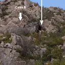
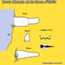
- Cova Obrada de la Roca d'UrúsPetita cova de 12 m. de longitud, penjada al cingle del Solà de la Roca d'Urús (Cerdanya)
- Covetes de RiuTres minúscules cavitats al SO del poble de Riu de Cerdanya
- Bauma CR-1 del Coll RoigPetita balma de 6 metres de recorregut a Bellver de Cerdanya.
- Forat RodóPetita surgència de 7 metres de recorregut a Vilanova de Banat (Alàs i Cerc).
- Covetes del Prat de CastillóConjunt de quatre ínfimes coves a la Vall d'Ingla (Cerdanya)
- Cova de la ForancaPetita cova de 10 m. de recorregut vora el poblet d'Ordèn (Bellver de Cerdanya)
- Abric de la Vall d'InglaConjunt de balmes a la vall d'Ingla (Cerdanya) amb pintures rupestres
- Cova Nº1 de Roques RogesPetit túnel d'uns 10 m de llargada a Bellver de Cerdanya
- Avenc de la Bauma GranPetit avenc d'uns 4 m. de fondària a la zona de la Coma Oriola (la Masella, Cerdanya)
- Coveta de l'Infern d'en MartíÍnfima coveta vora l'Infern d'en Martí (Ordèn, Bellver de Cerdanya)
- Balma de les Roques RogesPetita balma a Bellver de Cerdanya
- Cova Nº3 de Roques RogesPetita esquerda ascendent a Bellver de Cerdanya
- Cova Nº2 de Roques RogesPetita cova descendent a Bellver de Cerdanya
- Cova del CinglePetita cova de 7 m. de recorregut a la vall d'Ingla (Cerdanya)
- Balma Alta de les Roques RogesBalma a la zona de les Roques Roges (Bellver de Cerdanya)
- Cova i d'OloptePetita cova de 8 m. de recorregut prop d'Olopte (Isòvol).
- Balma d'InglaÍnfima coveta de 8 m. de recorregut a la vall d'Ingla (Cerdanya)
- Bauma Gran de Coma OriolaGran balma d'uns 8 m. de fons a la zona de la Coma Oriola (la Masella, Cerdanya)
- Bauma Superior de la Roca d'UrúsBalma a la part alta del Solà de la Roca d'Urús (Cerdanya)
- Cova C-2 de les EscaldesPetita cova sobre la font de les Escaldes (Prullans)
- Tuta AmagadaCoveta a pocs metres de la cova de la Fou de Bor
- Cova Petita de l'ÓsPetita cova de 6 metres de recorregut a Alp.
- Forat de la Tartera del SaücPetita cova de 6 m. a Urús (Cerdanya)
- Cova F d'OloptePetita cova de 7 m. de recorregut prop d'Olopte (Isòvol).
- Tuta del CinglePetita cova de 7 m. de longitud per damunt del sistema de la Fou de Bor
- Balma de la CrestaPetita cova de poc més de 7 m. de recorregut a la zona de Coma Oriola (la Masella, Cerdanya)
- Cova D d'OloptePetita cova de 6 metres de recorregut prop d'Olopte (Isòvol).
- Cova H d'OloptePetita cova de 6 m. de recorregut prop d'Olopte (Isòvol).
- Coveta del Congost de la Font LlebreraPetita cova de 6 m. de longitud prop d'Urús (Cerdanya)
- Balma del VentPetita balma al Tossal d'Isòvol (la Cerdanya)
- Cova Petita d'InglaÍnfima coveta de 5 m. de recorregut a la vall d'Ingla (Cerdanya)
- Cova dels MorosPetita cova de 5 metres de recorregut a Vilanova de Banat (Alàs i Cerc).
- Tuta del BarrancCoveta de 5 m. de recorregut vora la Tuta Freda (Cova de la Fou de Bor)
- Bauma Inferior de la Roca d'UrúsPetita concavitat al Solà de la Roca d'Urús (Cerdanya)
- Cova del ToixóPetita cova sobre la font de les Escaldes (Prullans)
- Balma Obrada del Grau de l'ÓsPetita balma reconvertida en habitacle al Grau de l'Ós (Riu de Cerdanya)
- Coveta Obrada de VimaÍnfima coveta vora el Mas de Vima (Cava, Alt Urgell)
- Forat de l'Orri d'AristotPetita cova al N d'Aristot
- Bauma Penjada de Coma PregonaPetita balma a Coma Pregona (la Masella, Alp)
- Coveta de FontfredaPetita cova de 5 m de longitud a la Vall d'Ingla
- Tuta Petita de MenúsÍnfima coveta prop de Béixac (Montellà i Martinet)
- Cova d'en Pere FerrerDiminuta cova a la capçalera de la vall d'Ingla (Cerdanya)
- Bauma Més PetitaÍnfima coveta de 3 m. de recorregut a la Coma Oriola (la Masella, Cerdanya)
- Bauma PetitaÍnfima cova de 3 m. de fons a la Coma Oriola (la Masella, Cerdanya)
- Balma de Sant Martí dels CastellsÍnfima balma a Prullans
- Infern d'en MartíAvenc de 20 m. de fondària vora el poblet d'Ordèn (Bellver de Cerdanya). Sembla desaparegut per col·lapse.