Caves and shafts in Berguedà
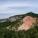
In Berguedà, the relief of the Cadí-Moixeró and Pedraforca turns much of the county into mid-to-high mountain karst terrain, with a high number of cataloged caves and potholes and some of the deepest vertical systems in the catalog. The combination of powerful limestones and abrupt relief makes potholes with significant elevation drops common there, more so than long horizontal caves.
The catalogue includes 256 cavitats (152 coves i 104 avencs) in Berguedà, concentrated in Gisclareny, Castellar del Riu and Bagà. Cova de Rotgers (R-2, R3, R-4, R-5, R-6), amb 1089 m de recorregut.
The surveyed length of the caves with this data ranges from 2 to 1089 metres. The depth ranges from 1 to 188 metres. 5 different rock types are recorded here. You can check the full entry for location, access and, where available, photographs and survey maps. The whole set of caves on this page can also be downloaded as CSV or JSON.
Berguedà has an area of 1185 km², located mostly in el Prepirineu. This means an approximate density of 21.6 catalogued caves per 100 km².
Municipalities
- Gisclareny49
- Castellar del Riu23
- Bagà22
- Saldes17
- Castellar de n'Hug16
- Guardiola de Berguedà14
- Gósol11
- la Nou de Berguedà11
- Vilada11
- Vallcebre10
- Capolat9
- Sant Julià de Cerdanyola8
- Fígols7
- la Pobla de Lillet7
- Borredà6
- Castell de l'Areny5
- Santa Maria de Merlès5
- Berga4
- Montmajor4
- la Quar4
- Avià4
- Casserres3
- Sant Jaume de Frontanyà2
- Olvan2
- l'Espunyola1
- Sagàs1
Rock Types
- Cova de Rotgers (R-2, R3, R-4, R-5, R-6)Cova en guixos de 1089 metres de recorregut i 76 metres de desnivell al municipi de Borredà.
- Grallera del CarabasserImportant avenc de 166 m. de fondària al Pedraforca (Saldes)
- Antic BullidorInteressant avenc de 188 metres de fondària variable, situat a Gisclareny.
- Surgència de RusImportant surgència activa de 555 m de recorregut a Castellar de n'Hug.
- Esquerdes de PalomeraImportant conjunt d'esquerdes vora la Pleta de la Vila (Saldes)
- Bòfia de la CorbaInteressant avenc de 110 m. de fondària al Rasos de Peguera
- Les CambrotesComplicat conjunt d'esquerdes d'uns 350 m. de recorregut a Vallcebre (Berguedà)
- Bòfia del TecCova de 332 metres de recorregut a la llera del riu Aigua de Llinars, Fígols.
- Forats de Sant TelmCavitat tectònica de 51m de fondària i 316m de recorregut a l'extrem occidental de la Serra d'Ensija
- Forat de les OllesAvenc de 60 metres de desnivell al Pedraforca (Saldes).
- Avenc de l'ArenyAvenc de 65 metres de fondària a Castell de l'Areny.
- Tuta de SausCova de 186 metres de recorregut a la Pobla de Lillet.
- Graller de Roca CerdanaCavitat de 96 metres de fondària al municipi de Saldes.
- Bòfia de RasetsAvenc de 65 m. de fondària a la zona de Rasets (Castellar del Riu).
- Cova i Avenc del CalvariPetit sistema de 193 m. de recorregut a Vilada (Berguedà)
- Graller de la Pleta de l'ÓsCavitat de 70 m. de desnivell al municipi de Saldes
- Avenc de les PedresAvenc de 78 m. de fondària a la zona de Rasets (Castellar del Riu).
- Avenc dels BoletsAvenc de -47 metres a Castellar del Riu
- Forat del GatAvenc de 54 metres a Saldes.
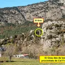
- Cova del GrauCaòtica cavitat de 127 m de recorregut a la Nou de Berguedà
- Bòfia del PedróGran depressió de 28 metres de Fondària als Rasos de Peguera (Fígols).
- Forat Gran de la Feixa AltaAvenc de 50 metres de desnivell amb tres boques d'accés al Pedraforca, Saldes.
- Bòfia de l'Obaga d'EspadesCavitat de 105 m. de recorregut a la Nou de Berguedà
- Cova de Ca l'IsidretCova de 90 m. de recorregut a Vallcebre.
- Avenc de Coll de PalAvenc de 26 metres de desnivell al municipi de Bagà.
- Coves del MonnellCova amb dues boques d'accés i 92 metres de recorregut a Gisclareny .
- Bòfia de les CingladesInteressant cavitat de 39 m. de desnivell a la Serra d'Ensija (el Berguedà)
- Avenc EdelweissAvenc de 29 m. de fondària al Pla de la Corba (Rasos de Peguera)
- Forat del Pas de l'OsAvenc de 33 m de fondària a Castellar de n'Hug.
- Cova de Rotgers R-1Cova en guixos de 78 metres de recorregut al municipi de Borredà.
- Bauma de l'ArcadaArcada de 18 metres de desnivell a Bagà.
- Cova de RocaterçanaCova de 83 metres de recorregut a la base del cingle de la Roca Terçana (Capolat).
- Avenc del GrauInteressant cavitat a la Nou de Berguedà
- La TutaCova de 83 metres de recorregut a Castellar de n'Hug
- Grallera de Forat MicóAvenc de 26 metres de fondària a Saldes.
- Avenc de les EresAvenc de 30 m. de fondària al NO de Vilada
- Graller de Set FontsPetit avenc de 23 metres de fondària al Pedraforca, Gósol.
- Avenc RaimundoAvenc de 32 m. de fondària al NO de Vilada
- Arcada TM-1 del Torrent de la MiquelaBonica Arcada de 26 metres de desnivell a Guardiola de Berguedà.
- Cova Nº2 de Ca l'IsidretCova de 57 m de recorregut a Vallcebre
- Avenc de ComabellaPetit avenc a la zona de Comabella (Bagà)
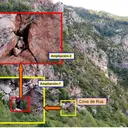
- Cova de RusCavitat amb 6 boques i 63 metres de recorregut a Castellar de n'Hug.
- L'EscletxaCova de 66 metres de recorregut a Castellar del Riu.
- Avenc SC-40Avenc de 30 metres de fondària a la Pleta de l'Olla, (Gisclareny).
- Avenc MullatPetit avenc de 14 metres de fondària a la zona de Rasets (Castellar del Riu).
- Avenc RS-2 de Roca SançaEsquerda de 20 metres de fondària a Guardiola de Berguedà.
- Forat Nº1 del TarterAvenc de 19 metres de fondària al cim de Pla Baguet (Castellar de n'Hug)
- Surgència de les Nou FontsCova de 72 metres de recorregut a Sant Julià de Cerdanyola.
- Forat NegrePetita travessa d'uns 50 metres de recorregut i -21 metres de profunditat a Vallcebre.
- Graller dels Rocs de CanellsAvenc de 19 metres de fondària a la zona de Coll de Pal (Bagà).
- Avenc G-1Gran depressió de 28 metres de fondària al coll de l'Escriga (Gisclareny).
- Avenc del Coll d'EscriuAvenc de 27 metres de fondària a Guardiola de Berguedà.
- Cova SC-30Cova de 60 metres de recorregut a Gisclareny.
- Forat del Clot del MoroAvenc de 19 metres de desnivell a Castellar de n'Hug.
- Forat dels EugassersCova de 60 metres de recorregut a Guardiola de Berguedà.
- Cova de les LlosanquesConeguda cova d'uns 16 m. de fondària als Rasos de Peguera
- Avenc Fred de VallcebreLlarga esquerda de 16 m. de fondària a la zona de les Cambrotes (Vallcebre, Berguedà)
- Esquerda SG-5Petita cavitat tectònica a Bagà
- Cova SC-73Cova de 43 metres de recorregut a l'Afrau (Gisclareny).
- Forat de les GrallesAvenc de 26 metres de fondària al Pedraforca, Gósol.
- Cova del MassanaAmagada cova a la serra de Picancel (la Quar, Berguedà)
- Avenc de la TorrotaPetit avenc de 15 m. de fondària a la zona de Rasets (Castellar del Riu).
- Avenc de la Font del FaigAvenc de 18 metres de desnivell a Guardiola de Berguedà.
- Avenc del Puig Cubell de ViladaEsquerda de 18 m de fondària al Puig Cubell (Vilada, Berguedà)
- Avenc de la Roca TiravalAvenc de 27 metres de fondària a Bagà
- La Dou del BastarenySurgència de 45 metres de recorregut a Gisclareny.
- Balma MolosaGrandiosa balma a la Quar (Berguedà)
- Cova de la Canal del SantPetita cova ascendent a La Quar (Berguedà).
- Escletxa del GelEsquerda de 19 metres de fondària al Coll de la Bòfia (Bagà).
- Cova de RosetGran balma penjada al torrent de Comabona (Saldes)
- Bullidor de la LletSurgència vauclusiana de 20 metres de fondària variable, situat a Gisclareny.
- Forat d'EstelaLlegendari avenc de 20 m. de fondària al cim de la Roca d'Auró (Castellar del Riu).
- Cova de l'Hostal del GuiuPetita cova de 44 metres de recorregut a Berga.
- Forat CB-6 de la Collada de la BòfiaEsquerda de 9 m. de fondària a la zona de la Collada de la Bòfia (Bagà)
- Avenc CP-2Esquerda d'uns 20 m de fondària al Serrat Gran (Bagà)
- Tuta de la MasenaCova de 45 metres de recorregut a Bagà
- Avenc de la Nevera de PuigventósCova de 41 metres de recorregut a la zona de Rasets, Castellar del Riu.
- Avenc de Can MasoverAvenc de 18 metres de desnivell a Gósol.
- Forat de les PlanesAvenc d'11 metres de fondària a Sant Jaume de Frontanyà.
- Grallera de CatllaríAvenc de 18 metres de Fondària als Rasos de Peguera (Fígols).
- Avenc del CampamentAvenc de 17 m. de fondària a la zona de Rasets (Castellar del Riu).
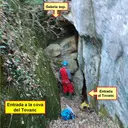
- Cova del TovancCuriosa cavitat plena de gours, a Olvan (Berguedà)
- El Pont CabradísTúnel natural de 45 m. de recorregut al riu Aigua de Valls (Berguedà).
- Forat del PuigPetita cavitat de 15 metres de fondària situada a Sant Julià de Cerdanyola.
- Forat del Clot dels TorrentsAvenc de 15 metres de fondària al torrent de la Font del Boix (Castellar de n'Hug)
- Forat de l'AuroraPetita cova de 35 metres de recorregut a Gisclareny.
- Forat del PuigAvenc de 18 metres de desnivell a la Pobla de Lillet.
- Forat Superior del Roc de la ClusaAvenc de 16 m de fondària al Roc de la Clusa (Castell de l'Areny).
- Avenc del Cingle de la CorbaPetit avenc de 15 m. de fondària al Pla de la Corba (Rasos de Peguera)
- Cova de Coma CastellanaCova de 34 metres de recorregut a Guardiola de Berguedà
- Avenc de la NeveraPetita cavitat de 5 m. de desnivell a la zona de Rasets, Castellar del Riu.
- Avenc de SadornAvenc de 17 metres de fondària al Serrat de la Muga (Gisclareny)
- Avenc ForadatAvenc de 18 metres de fondària al canó de la Muga, (Gisclareny).
- Cova del DiedrePetita cova de 30 metres de recorregut al Pedraforca, Saldes.
- Cova de Can MauriCova de 40 metres de recorregut a Berga.
- Avenc SC-42Avenc de 12 metres de fondària a la Pleta de la Guilla, (Gisclareny).
- Forat Enfonsat de la CorbaCavitat d'11 metres de fondària, prop del Pla de la Corba (Castellar del Riu).
- Cova de l'ArenyCova de 40 metres de recorregut a Castell de l'Areny.
- Cova de FalgarsCova de 30 metres de recorregut a la Pobla de Lillet.
- Forat de l'AvellanosaAvenc de 12 metres de fondària a la Pleta de l'Olla, (Gisclareny).
- Baumot del VimbocaPetita cova de 21 metres de recorregut a Gisclareny.
- Balma de la Cambra dels BocsEspectacular balma a Gisclareny.
- Forat Inferior del Roc de la ClusaCova de 27 m de recorregut a la base del Roc de la Clusa (Sant Julià de Cerdanyola).
- Avenc SC-44Avenc d'11 metres de fondària a la Pleta de la Guilla, (Gisclareny).
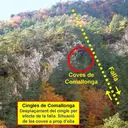
- Cova Nº1 de ComallongaPetita cova ascendent a Castellar de n'Hug (Berguedà)
- Cova del Rec de les MuntanyetesCova de 34,6 metres de recorregut al Rec de les Muntanyetes (La Pobla de Lillet).
- Avenc dels EncantatsAvenc de 10 metres de fondària a Gósol.
- Cova del RelleixPetita cova de 23 m. de recorregut a Vallcebre.
- Cova del CamalleroCova de 22 m. de recorregut a la zona de Rasets (Castellar del Riu).
- Forat del Coll dels TrullsAvenc de 12 metres de fondària al Coll de Trulls (Gisclareny).
- Forat de les OliveresPetit avenc de 11 m. de fondària a la Nou de Berguedà
- Cova de les GrallesCova de 26 metres de recorregut a la base del cingle de Rocaterçana (Capolat)
- Avenc dels QuatrePetit avenc de 10 m. de fondària a la zona de Rasets (Castellar del Riu).
- Pou del PortetPetit avenc de 12 metres de fondària a Castellar del Riu.
- Esquerda SG-2Petita cavitat tectònica al Serrat Gran (Bagà)
- Esquerda SG-3BPetita cavitat tectònica al Serrat Gran (Bagà)
- Cova de les GuatllesCova de 19 metres de recorregut a la base del Cingle de Rocaterçana (Capolat).
- Esquerda de Serra CabiroleraPetita esquerda entre blocs a Serra Cabirolera (Cadí)
- Cova del VimbocaPetita cova de 21 metres de recorregut a Gisclareny.
- L'Església de les CingladesPetita, però curiosa cavitat, situada sota el Serrat Voltor (Serra d'Ensija)
- Bòfia de la RaconadaPetit avenc d'11 m. de fondària a la Serra d'Ensija
- Cova de les Nou FontsCova de 31 metres de recorregut a Sant Julià de Cerdanyola.
- Segon Forat de la Canal ClosaPetit avenc de 9 m. de fondària a la Canal Closa (Vilada)
- Bauma CD-1 del Coll de DeogràciesBalma de 21 metres de recorregut a Guardiola de Berguedà.
- Bòfia de l'AdelinaAvenc de 8 metres de fondària prop de la riera de Merlès (Borredà).
- Bòfia de la Canal del JaumePetit avenc de 10 m. de fondària a la Serra d'Ensija
- Balma de l'ÍnsulaGran balma situada a la Nou de Berguedà
- Cova NegraCova de 20 m. de recorregut a Vallcebre.
- Bòfia d'en PepetAvenc de 8 metres de fondària prop de la riera de Merlès (Borredà).
- Grallera de les Costes de PegueraAvenc de 12 metres de fondària a Fígols.
- Bòfia de Can TorneulaCova de 26 metres de longitud a Capolat
- Forat del CallarotAvenc d'11 metres de fondària a l'Oest del cim de Pla Baguet (Castellar de n'Hug)
- Coves Nº2, 3 i 4 de ComallongaConjunt de tres petites coves a Castellar de n'Hug (Berguedà)
- Avenc SC-33Petit avenc de 10 metres de profunditat a Gisclareny.
- Ressurgència de la TavernaSurgència temporal de 22 metres de recorregut a Capolat.
- Avenc Negre de VallcebrePetita esquerda de 7 m. de fondària a la zona de les Cambrotes (Vallcebre, Berguedà)
- Cova de l'ÍnsulaPetita cova de 25 m. de recorregut a la Nou de Berguedà
- Bauma RC-1 del Roquer del ClaperBalma de 17 metres de recorregut a Guardiola de Berguedà.
- Bòfia de Coma ReïnaPetita cova de 25 metres de recorregut a les Canals de Catllarí, (Montmajor).
- Forat del Grau del VerdetPetit avenc de 8 metres de fondària al Pedraforca, Gósol.
- Cova SM-3Cova de 23 metres de recorregut al Serrat de la Muga (Gisclareny)
- Cova SC-28Petita cova de 24 metres de recorregut a Gisclareny.
- Balma de la VaqueraPetita cavitat situada a Vilada (Berguedà)
- Cova del CingleCova de 19 metres de recorregut a la zona de Rasets, Castellar del Riu.
- Avenc SM-2Petit avenc de 8 metres de fondària al coll de Vimboca (Gisclareny)
- Foradada de la Canal ForadadaPetita foradada descendent a Vilada (Berguedà)
- Forat Gran del TarterAvenc de 7 metres de fondària al cim de Pla Baguet (Castellar de n'Hug)
- Cova del MassanaPetita cova a Guardiola de Berguedà
- Esquerdes de Santa EugèniaPetita esquerda a Sant Jaume de Frontanyà
- Avenc de Roca RojaPetit avenc a Gósol.
- Primer Forat de la Canal ClosaPetita cavitat de 5 m. de fondària i 16 m. de recorregut a Vilada (Berguedà)
- Forat de Serra CabiroleraPetita esquerda a la Serra Cabirolera (Cadí)
- Cova ArtigasCova de 21 metres de recorregut a La Pobla de Lillet
- Cova de la SoleCova de 21 metres de recorregut prop de la Roca Gran (Guardiola de Berguedà).
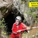
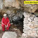
- Cova del DesertorPetita cova utilitzada de refugi durant la guerra civil a Gósol.
- Cova de l'Home MortCova de 16 metres de recorregut prop del coll de la Creueta (Castellar de n'Hug)
- Cova M-4Petita cova de 12 metres de recorregut a Gisclareny.
- Cova del RosetPetita cova de 18 metres de recorregut a Saldes.
- Esquerda SG-3APetita cavitat tectònica al Serrat Gran (Bagà)
- Cova de l'EngorjatPetita cova de 14 metres situada a Sant Julià de Cerdanyola.
- Esquerda CB-2 del Coll de la BòfiaEsquerda de 6 metres de fondària a Bagà.
- Cova del Pas de l'EscalellPetita cova amb força formació a Castell de l'Areny
- Cova de la GranotaCova de 15 metres de recorregut a Castellar de n'Hug
- Balma de Ca l'AndalóLlarga balma en gresos a Santa Maria de Merlès (Berguedà)
- Esquerda RS-1 de Roca SançaEsquerda d'11 metres de recorregut a Bagà.
- Avenc dels DesertorsPetit avenc a la Nou de Berguedà
- Cova SC-74Cova de 12 metres de recorregut al canó de la Muga, (Gisclareny).
- Cova del CatíPetita cova a Gósol.
- Cova del Salt del LlopCova de 14 metres de recorregut prop de les Fonts del Llobregat (Castellar de n'Hug)
- Cova de l'Estret de RiugréixerCova de 15 metres de recorregut a Bagà.
- Cova de RoquetesPetita cavitat a Borredà.
- La CambrotaCova de 16 m. de recorregut a Vallcebre.
- Cova CD-2 del Coll de DeogràciesBalma de 12 metres de recorregut a Guardiola de Berguedà.
- Avenc SC-24Petit avenc de 5 metres de desnivell a Gisclareny.
- Bauma de les RocassesGran balma amb salt d'aigua a Santa Maria de Merlès
- Esquerda SG-1Petita cavitat tectònica al Serrat Gran (Bagà)
- Bauma dels GitanosInteressant bauma a Borredà.
- Bauma de ComamoreraÀmplia balma vora el Salt de Sallent (Capolat, Berguedà)
- Bauma GranGran balma vora Capolat (Berguedà)
- Forat del Coll de les AgudesPetit avenc de 5 metres de fondària al Pedraforca, Saldes.
- Espluga RodonaPetita cova de 14 metres de longitud a Saldes.
- Avenc de la PistaÍnfim avenc de 5 metres de fondària al coll d'Escriga (Gisclareny).
- Cova PT-4 de Puig TerrersPetita cova de 9 metres de recorregut als cingles de Puig Terrers (Gisclareny)
- Cova Gran del Santuari de les EsposesPetita cova de 12 metres situada a Sant Julià de Cerdanyola.
- Balma de Cal CalauBalma de 12 metres de fons a Casserres.
- Balma de les HeuresBalma murada al municipi de la Quar (Berguedà)
- Coves dels DesertorsDues petites coves a la Nou de Berguedà
- Balma Petita de la Cambra dels BocsBalma a Gisclareny.
- Esquerda SG-4Petita cavitat tectònica al Serrat Gran (Bagà)
- Cova PT-1 de Puig TerrersPetita cova de 10 metres de recorregut als cingles de Puig Terrers (Gisclareny)
- Cova CM-1Cova de 10 metres de recorregut al canó de la Muga, (Gisclareny).
- Avenc Petit de la CorbaPetit avenc d'uns 5 m. de profunditat al Pla de la Corba (Rasos de Peguera)
- Cova del Doctor ÀngelPetita cova prop de Malanyeu (la Nou de Berguedà)
- Bauma de la Frau de Sant EliesEspectacular balma amb cascada a la riera de Fontcaldes (Avià).
- Cova SC-26Ínfima cova de 7 metres de recorregut a Gisclareny.
- Esquerda R.9 de RasetsPetita esquerda a la zona de Rasets, Castellar del Riu.
- Cova de la Canal del Castell de RosetPetita cova vora el Castell de Roset (Vilada)
- Esquerda SG-6Petita fissura al Serrat Gran (Bagà)
- Esquerda del Coll de les AgudesMinúscul avenc de 3 metres de fondària al Pedraforca, Saldes.
- Cova PT-7 de Puig TerrersPetita cova de 8 metres de recorregut a la zona de Puig Terrers (Gisclareny)