Caves and shafts in Cadí - Moixeró
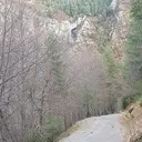
The massif of Cadí-Moixeró, protected as a natural park and with Pedraforca as Catalonia’s most photographed peak, extends across Alt Urgell, Berguedà and Cerdanya. Formed by powerful Cretaceous limestones with high-mountain relief, it is one of the benchmark karst terrains of the Catalan Pyrenees, with some of the deepest and most technical vertical systems in the catalog – consistent with an elevation change exceeding 1,500 meters between the base and the ridges.
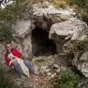
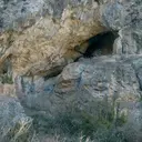
107 cavitats (60 coves i 47 avencs) in Cadí - Moixeró have been catalogued, mainly in Gisclareny, Josa i Tuixén and Saldes. Grallera del Carabasser, amb 470 m de recorregut.
The surveyed length of the caves with this data ranges from 2 to 470 metres. The depth ranges from 1 to 188 metres. 2 different rock types are recorded here. You can check the full entry for location, access and, where available, photographs and survey maps. The whole set of caves on this page can also be downloaded as CSV or JSON.
Counties: Alt Urgell, Berguedà, Cerdanya
Rock Types
- Grallera del CarabasserImportant avenc de 166 m. de fondària al Pedraforca (Saldes)
- Antic BullidorInteressant avenc de 188 metres de fondària variable, situat a Gisclareny.
- Forat de les OllesAvenc de 60 metres de desnivell al Pedraforca (Saldes).
- Graller de Roca CerdanaCavitat de 96 metres de fondària al municipi de Saldes.
- Grallera Gran del BoixederAvenc de 81 m. de fondària a la Serra del Cadí
- Baborell de MontsecAvenc de 18 metres de desnivell prop de coll d'Arnat (la Vansa i Fórnols)
- Forat del GatAvenc de 54 metres a Saldes.
- Forat Gran de la Feixa AltaAvenc de 50 metres de desnivell amb tres boques d'accés al Pedraforca, Saldes.
- Coves del MonnellCova amb dues boques d'accés i 92 metres de recorregut a Gisclareny .
- Grallera Gran de CornellanaAvenc de 42 m. de fondària al Cadí (La Vansa i Fórnols)
- Avenc de CerneresAvenc de 40 metres de fondària a Josa de Cadí.
- Graller de Set FontsPetit avenc de 23 metres de fondària al Pedraforca, Gósol.
- Avenc SC-40Avenc de 30 metres de fondària a la Pleta de l'Olla, (Gisclareny).
- Grallera Petita del BoixederPetit avenc de 26 m. de fondària a la Serra del Cadí
- Avenc G-1Gran depressió de 28 metres de fondària al coll de l'Escriga (Gisclareny).
- Avenc del Coll d'EscriuAvenc de 27 metres de fondària a Guardiola de Berguedà.
- Cova SC-30Cova de 60 metres de recorregut a Gisclareny.
- Cova Gran de CerneresCova de 53 metres de recorregut a Josa de Cadí.
- Forat de la Bruixa de la Canal BaridanaAvenc de 20 metres de fondària a la canal Baridana de Josa (Josa i Tuixén)
- Cova SC-73Cova de 43 metres de recorregut a l'Afrau (Gisclareny).
- Forat de les GrallesAvenc de 26 metres de fondària al Pedraforca, Gósol.
- Avenc de la Font del FaigAvenc de 18 metres de desnivell a Guardiola de Berguedà.
- Cova dels EsquerolsPetita cova en rampa de 44 m. de recorregut a Josa del Cadí
- Avenc de la Roca TiravalAvenc de 27 metres de fondària a Bagà
- La Dou del BastarenySurgència de 45 metres de recorregut a Gisclareny.
- Cova de RosetGran balma penjada al torrent de Comabona (Saldes)
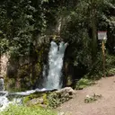
- Bullidor de la LletSurgència vauclusiana de 20 metres de fondària variable, situat a Gisclareny.
- Tuta de la MasenaCova de 45 metres de recorregut a Bagà
- Espluga Nº3 dels LladresPetita cova de 35 metres de recorregut a Ribera d'Urgellet.
- Avenc MarquèsAvenc de 14 metres de fondària a Montant de Tost (Ribera d'Urgellet).
- Avenc de Can MasoverAvenc de 18 metres de desnivell a Gósol.
- Forat de l'AuroraPetita cova de 35 metres de recorregut a Gisclareny.
- Cova de Coma CastellanaCova de 34 metres de recorregut a Guardiola de Berguedà
- Cova del Torrent dels CortilsPetita cova sota Prat Llong (Cadí)
- El TutCova de 40 metres de recorregut a Cerneres (Josa i Tuixén).
- Avenc de SadornAvenc de 17 metres de fondària al Serrat de la Muga (Gisclareny)
- Avenc ForadatAvenc de 18 metres de fondària al canó de la Muga, (Gisclareny).
- Cova del DiedrePetita cova de 30 metres de recorregut al Pedraforca, Saldes.
- Avenc SC-42Avenc de 12 metres de fondària a la Pleta de la Guilla, (Gisclareny).
- Forat de l'AvellanosaAvenc de 12 metres de fondària a la Pleta de l'Olla, (Gisclareny).
- Baumot del VimbocaPetita cova de 21 metres de recorregut a Gisclareny.
- Balma de la Cambra dels BocsEspectacular balma a Gisclareny.
- Cova dels GegantsCova de 34 metres de recorregut a La Vansa i Fórnols
- Avencs Petits de CerneresCavitat de 10 m de fondària a la serra del Cadí
- Avenc SC-44Avenc d'11 metres de fondària a la Pleta de la Guilla, (Gisclareny).
- Avenc dels EncantatsAvenc de 10 metres de fondària a Gósol.
- Cova del CabanilAvenc de 9 metres de fondària a Tuixent
- Forat del Coll dels TrullsAvenc de 12 metres de fondària al Coll de Trulls (Gisclareny).
- Cova del SoldatCova de 27 metres de recorregut a Fórnols.
- Esquerda de Serra CabiroleraPetita esquerda entre blocs a Serra Cabirolera (Cadí)
- Cova del VimbocaPetita cova de 21 metres de recorregut a Gisclareny.
- Avenc SC-33Petit avenc de 10 metres de profunditat a Gisclareny.
- Forat del Grau del VerdetPetit avenc de 8 metres de fondària al Pedraforca, Gósol.
- Cova SM-3Cova de 23 metres de recorregut al Serrat de la Muga (Gisclareny)
- Cova SC-28Petita cova de 24 metres de recorregut a Gisclareny.
- Avenc SM-2Petit avenc de 8 metres de fondària al coll de Vimboca (Gisclareny)
- Cova Petita de CerneresCova de 17 metres de recorregut a Josa de Cadí.
- Avenc de Roca RojaPetit avenc a Gósol.
- Espluga Nº1 dels LladresPetita cova de 16 metres de recorregut a Ribera d'Urgellet.
- Forat de Serra CabiroleraPetita esquerda a la Serra Cabirolera (Cadí)
- Cova de la SoleCova de 21 metres de recorregut prop de la Roca Gran (Guardiola de Berguedà).
- Cova M-4Petita cova de 12 metres de recorregut a Gisclareny.
- Cova del RosetPetita cova de 18 metres de recorregut a Saldes.
- Grallera Petita de CornellanaPetit avenc de 7 m. de fondària al Cadí (La Vansa i Fórnols)
- Forat de la NeuPetit avenc de 6 metres de fondària a Josa de Cadí.
- Forat MicóPetita cova de 18 m. de recorregut vora Josa del Cadí
- Cova SC-74Cova de 12 metres de recorregut al canó de la Muga, (Gisclareny).
- Cova del CatíPetita cova a Gósol.
- Cova de l'Estret de RiugréixerCova de 15 metres de recorregut a Bagà.
- Cova N-1Petita cova de 10 metres de recorregut a Josa de Cadí.
- Avenc SC-24Petit avenc de 5 metres de desnivell a Gisclareny.
- Bauma del PontCova de 10 metres de recorregut al municipi de Josa i Tuixén.
- Forat del Coll de les AgudesPetit avenc de 5 metres de fondària al Pedraforca, Saldes.
- Espluga RodonaPetita cova de 14 metres de longitud a Saldes.
- Avenc N-3Petit avenc de 5 metres de fondària a Josa de Cadí.
- Avenc de la PistaÍnfim avenc de 5 metres de fondària al coll d'Escriga (Gisclareny).
- Cova PT-4 de Puig TerrersPetita cova de 9 metres de recorregut als cingles de Puig Terrers (Gisclareny)
- Balma Petita de la Cambra dels BocsBalma a Gisclareny.
- Cova PT-1 de Puig TerrersPetita cova de 10 metres de recorregut als cingles de Puig Terrers (Gisclareny)
- Cova CM-1Cova de 10 metres de recorregut al canó de la Muga, (Gisclareny).
- Baumes del MolíBaumes d'11 metres de fons a Josa de Cadí.
- Cova SC-26Ínfima cova de 7 metres de recorregut a Gisclareny.
- Esquerda del Coll de les AgudesMinúscul avenc de 3 metres de fondària al Pedraforca, Saldes.
- Cova PT-7 de Puig TerrersPetita cova de 8 metres de recorregut a la zona de Puig Terrers (Gisclareny)
- Cova PT-5 de Puig TerrersPetita cova de 9 metres de recorregut al torrent que baixa de Puig Terrers (Gisclareny)
- Cova de la Font del CristallPetita cova d'uns 10 metres de recorregut a la part alta de la serra del Cadí.
- Bauma del CaldererGran balma de 10 metres de longitud al Pedraforca, Saldes.
- Forat de les BoixederesÍnfim avenc de 3 metres de fondària a La Vansa i Fórnols.
- Avenc del Cim del ComabonaPetit avenc prop del cim del Comabona, (Gisclareny).
- Cova de la SerpPetita cova de 8 metres de recorregut a la Pleta de l'Olla, (Gisclareny).
- Cova de PlugaoscuraCova de 9 metres de recorregut al municipi de Josa i Tuixén.
- Cova dels EmpedratsPetita cova de 9 metres de recorregut al congost dels Empedrats. Gisclareny.
- Cova SC-29Ínfima cova de 6 metres de recorregut a Gisclareny.
- Cova N-4Ínfima cova de 6 metres de recorregut a Josa de Cadí.
- Cova N-2Ínfima cova de 5 metres de recorregut a Josa de Cadí.
- Cova PT-8 de Puig TerrersÍnfima cova de 5 metres de recorregut al torrent que baixa de Puig Terrers (Gisclareny)
- Avenc G-3Ínfima esquerda a la zona del coll d'Escriga (Gisclareny).
- Forat del CaldererPetit conducte de 7 metres de recorregut al Pedraforca, Saldes.
- Balma NegraGran paret balmada abans d'arribar a Gisclareny
- Cova SM-1Petita cova de 3 metres de recorregut al Serrat de la Muga (Gisclareny)
- Cova SC-27Ínfima cova de 4 metres de recorregut a Gisclareny.
- Balma de la Casa del BisbeBalma amb restes d'edificació troglodítica prop de Gisclareny.
- Espluga Nº2 dels LladresÍnfima cova de 3,5 metres de recorregut a Ribera d'Urgellet.
- Cova PT-6 de Puig TerrersConjunt de dues ínfimes coves al torrent que baixa de Puig Terrers (Gisclareny)
- Cova PT-2 de Puig TerrersÍnfima coveta al torrent que baixa de Puig Terrers (Gisclareny)
- Cova PT-3 de Puig TerrersÍnfima coveta al torrent que baixa de Puig Terrers (Gisclareny)
- Bullidor de Sant EsteveImportant surgència impenetrable a Gisclareny.