Caves and shafts in Cap de Creus
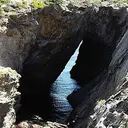
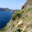
Cap de Creus, the easternmost point of the Iberian Peninsula and Catalonia’s first coastal-and-inland Natural Park, is a slate massif shaped by the tramuntana wind, in Alt Empordà. This lithology, unusual for karst – metamorphic rock rather than limestone – generates erosion cavities and shelters of a different type from those usual in the catalog, in a landscape that has inspired artists such as Dalí.
15 cavitats in Cap de Creus have been catalogued, mainly in Roses, el Port de la Selva and Cadaqués. Cau del Lliri, amb 460 m de recorregut.
The surveyed length of the caves with this data ranges from 3 to 460 metres. The depth ranges from 1 to 73 metres. 6 different rock types are recorded here. You can check the full entry for location, access and, where available, photographs and survey maps. The whole set of caves on this page can also be downloaded as CSV or JSON.
County: Alt Empordà
Rock Types
- Cau del LliriCova de 460 metres de recorregut i 73 metres de desnivell a Roses
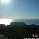
- Cova del TraireCova de 54 metres de recorregut al Cap Norfeu (Roses).
- Cova de s'InfernConegudíssima cova marina situada al Cap de Creus (Cadaqués)
- Cova TassanaCova de 61 metres de recorregut a Cadaqués.
- Cova de les ErmitesCova de 33 metres de recorregut a Roses
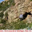
- Cova de la Veta NegraCavitat artificial de 28 m. de recorregut a Palau-saverdera (Alt Empordà)
- Cova de l'Aigua de MalaterraCova de 25 metres de recorregut a Roses.
- Cau de les GuillesPetita concavitat entre blocs a l'E de Roses
- Cova dels EncantatsCova de 10 metres de recorregut al Port de la Selva.
- Cova Nº 1 del Puig de la MalaterraBalma de 9 metres de recorregut a Roses
- Les CavorquesConjunt de petites coves desenvolupades en sorres, en el Port de la Selva.
- Cova del TorrellóCova de 7 metres de recorregut al Port de la Selva.
- Cova Nº 2 del Puig de la MalaterraCova de 6 metres de recorregut a Roses
- Cova de la PortaCova sepulcral de 5 metres de recorregut al Port de la Selva.
- Cova de CortalàsPetita cova d'interès arqueològic a Roses.