Caves and shafts in Garrigues
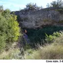
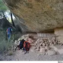
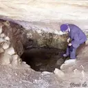
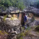
Garrigues is, above all, a county of plains and dry farmland, without the great limestone massifs that explain the density of cavities in other parts of the catalog. The cataloged caves and potholes are less numerous there, though not absent: they appear in the few reliefs that break the monotony of the plateau, often associated with small ravines.
85 cavitats (84 coves i 1 avenc) in Garrigues have been catalogued, mainly in la Granadella, Cervià de les Garrigues and la Pobla de Cérvoles. Cova dels Calaixos de l'Ereldo, amb 112 m de recorregut.
The surveyed length of the caves with this data ranges from 3 to 112 metres. The depth ranges from 1 to 9 metres. 2 different rock types are recorded here. You can check the full entry for location, access and, where available, photographs and survey maps. The whole set of caves on this page can also be downloaded as CSV or JSON.
Garrigues has an area of 798 km², located mostly in la Depressió Central. This means an approximate density of 10.7 catalogued caves per 100 km².
Municipalities
Rock Types
- Cova dels Calaixos de l'EreldoEsquerda de 112 m. de recorregut a la serra de la Llena
- Cova ForadadaCova de 41 metres de recorregut a la Granadella.
- Cova d'en PontGran balma amb dues boques, a Juncosa (les Garrigues)
- Esquerda del Riu SetPetita esquerda de 4,6 m de fondària a l'Albagés (les Garrigues)
- Cova de l'HostalBalma a la Granadella
- Cova del GetCova de 14 metres a La Pobla de Cérvoles
- Cova del CintetCuriosa balma prop del riu Set (la Pobla de Cérvoles)
- Cova Nº1 del GoriBalma obrada a la Granadella
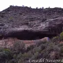
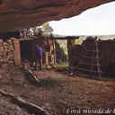
- Cova del Navarro dels SolansBalma murada a la Granadella
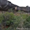
- Cova de l'Aran de la SolanaGran balma murada a la Granadella (les Garrigues)
- Cova del MartíBalma obrada a la Granadella
- Cova de l'Aranyó RomeuBalma obrada a la Granadella
- Cova de la Solana del MasotBalma a la Granadella
- Cova de l'Aran de l'ObagaGran balma murada a la Granadella (les Garrigues)
- Cova del Mariano BioscaBalma obrada a la Granadella
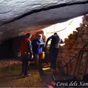
- Cova dels XampinyonsBalma obrada a la Granadella
- Cova Murada de l'AmpleBalma murada a la Granadella
- Cova de Cal BarberBalma obrada a la Granadella
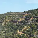
- Coves del CarnisserConjunt de 9 balmes a la Granadella.
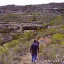
- Cova Gran del Camí del MolíCova murada a la Granadella.
- Cova de l'Aranyó FanxecBalma obrada a la Granadella
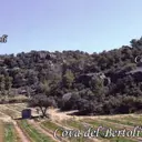
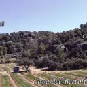
- Cova del BertolíBalma obrada a la Granadella
- Cova del JulioBalma murada a la Granadella
- Cova Llarga de Mateu VidalBalma a la Granadella
- Cova del Racó de BarcelonaBalma obrada a la Granadella
- Balma Murada dels TriquellBalma murada a la Granadella
- Cova dels Solans del SendrósBalma murada a la Granadella.
- Cova del CoculloBalma murada a la Granadella.
- Cova dels Solans de l'AldaberBalma murada a la Granadella.
- Cova de la Dolors de la LletBalma obrada a la Granadella
- Cova del BastéBalma a la Granadella
- Cova del MenotxBalma obrada a la Granadella
- Cova del MilioBalma obrada a la Granadella
- Cova del MoiàBalma obrada a la Granadella
- Cova del Pau VinyesBalma obrada a la Granadella
- Cova del CrematBalma obrada a la Granadella
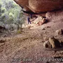
- Cova Nº1 de la Carretera de BoveraGran balma a la Granadella.
- Cova de les BessesBalma murada a Cervià de les Garrigues
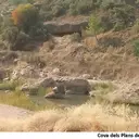
- Cova dels Plans de l'HostalÀmplia balma a Cervià de les Garrigues
- Cova del ClimentBalma obrada a la Granadella
- Cova de la Figuera d'en BlaiBalma obrada a la Granadella
- Cova de l'AmpleBalma obrada a la Granadella
- Cova del XipillaBalma murada a la Granadella
- Cova de BaladronsBalma obrada a la vall de Baladrons, el Cogul.
- Cova del Camí dels SolansBalma a la Granadella
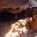
- Cova Palomera de l'IsidretConeguda balma a la Granadella (les Garrigues)
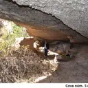
- Cova Nº5 de les GrallesÀmplia balma a Cervià de les Garrigues
- Cova ManuelaBalma murada a la Granadella
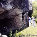
- Cova de la Font del QuicoBalma obrada a la Granadella
- Balma dels TriquellBalma murada a la Granadella
- Cova Nº2 de la Carretera de BoveraGran balma a la Granadella.
- Cova OscuraBalma a la Granadella.
- Cova de la BepaBalma murada a la Granadella.
- Cova del SecundinoBalma obrada a la Granadella
- Cova Nº1 del MoroBalma obrada a la Granadella
- Cova Nº2 del MoroBalma a la Granadella
- Cova Nº5 del MoroBalma a la Granadella
- Balma-Dormidor d'en PontBalma amb habitació, a Juncosa (Garrigues)
- Cova de la Vall ComancerdàBalma obrada a la Granadella
- Cova Inferior del CrematBalma a la Granadella
- Cova del ConradoBalma a la Granadella
- Cova Superior de TorrebessinaBalma obrada a la Granadella
- Cova Inferior de TorrebessinaBalma obrada a la Granadella
- Cova LlargaBalma murada a la Granadella.
- Cova del PicotBalma murada a la Granadella.
- Cova Nº2 del GoriBalma a la Granadella.
- Cova RodonaBalma a la Granadella
- Cova Petita del Camí del MolíBalma obrada a la Granadella
- Cova Nº3 del MoroBalma obrada a la Granadella
- Cova Nº4 del MoroBalma a la Granadella
- Balma Nº2 de Ca l'AntonietaBalma poc important a Cervià de les Garrigues
- Cova Nº2 de les BessesAmpla balma a Cervià de les Garrigues
- Cova dels GramenalsPetita balma a la Pobla de Cérvoles (Garrigues)
- La CovaBalma obrada a el Cogul
- Cova del QuimBalma obrada a la Granadella
- Cova de la Figuera RojaBalma amb cisterna d'aigua a la Granadella
- Cova Mateu VidalBalma a la Granadella
- Balma Nº1 de Ca l'AntonietaPetita balma a Cervià de les Garrigues
- Cova Nº3 de les GrallesÀmplia balma a Cervià de les Garrigues
- Balma-Assecador d'en PontBalma poc important, a Juncosa (Garrigues)
- Font de SatorreBalma amb font a la Granadella
- Cova del Manolo del PesBalma obrada a la Granadella
- La Roca dels MorosInteressant balma amb pintures rupestres al Cogul.
- Cova dels HospitaletsÀmplia balma, poc fonda, a Cervià de les Garrigues
- Cova del Mas del Ton MagíBalma obrada a la Granadella