Caves and shafts in Pla de l'Estany
Pla de l’Estany takes its name from the estany de Banyoles, a lake of karst-tectonic origin that is itself the county’s best-known manifestation of rock dissolution. The number of cataloged caves and potholes is small there, consistent with the small size of this essentially flat county.
19 cavitats (16 coves i 3 avencs) in Pla de l'Estany have been catalogued, mainly in Serinyà, Esponellà and Porqueres. Les Estunes, amb 210 m de recorregut.
The surveyed length of the caves with this data ranges from 2 to 210 metres. The depth ranges from 1 to 60 metres. 3 different rock types are recorded here. You can check the full entry for location, access and, where available, photographs and survey maps. The whole set of caves on this page can also be downloaded as CSV or JSON.
Pla de l'Estany has an area of 263 km², located mostly in la Serralada Transversal. This means an approximate density of 7.2 catalogued caves per 100 km².
Municipalities
Rock Types
- Avenc del TallAvenc de 60 m. de fondària a Martís (Esponellà)
- Les EstunesConjunt d'esquerdes de 210 metres de recorregut prop de l'estany de Banyoles (Porqueres)
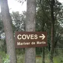
- Cova de Mariver de MartísInteressant cova amb dues boques i 110 metres de recorregut a Martís (Esponellà).
- Cova de les Encantades de MartísInteressant cova amb dues boques d'accés i 76 metres de recorregut a Martís (Esponellà).
- Cova de Can PortInteressant cova de 75 m de recorregut a ponent de l'estany de Banyoles
- Cova dels EncantatsInteressant cova amb dues boques d'accés i 69 metres de recorregut a Serinyà.
- Cova de Mariver de Martís Nº2Petita cova de 36 metres de recorregut a Martís (Esponellà).
- Avenc dels GossosPetit avenc de 6 m. de fondària a Martís (Esponellà)
- Cova de VentatjolCova de 28 m de recorregut al Pla de l'Estany
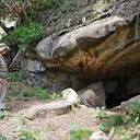
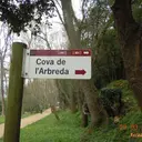
- Cova de l'ArbredaCova Prehistòrica a Serinyà
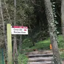
- Cova del Reclau ViverCova Prehistòrica de 20 metres de recorregut a Serinyà
- Avenc de l'AdministracióPetit avenc de 5 m. de fondària a Martís (Esponellà)
- Bora de la CarreteraPetita cova de 18 m. de recorregut a Serinyà.
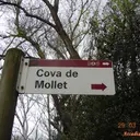
- Cova d'en MolletPetita cova Prehistòrica a Serinyà
- Bora Gran d'en CarreresInteressant jaciment paleolític situat a l'interior d'aquesta balma.
- Cova Petita dels EncantatsPetita cova amb restes arqueològiques de 5 metres de recorregut a Serinyà.
- Cova d'en PauPetit abric Prehistòric a Serinyà
- Cova de l'Arbreda PetitaPetita cova Prehistòrica a Serinyà
- Cova d'en Mollet IiiPetit abric Prehistòric a Serinyà