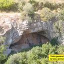
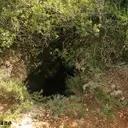
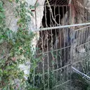
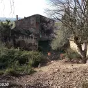
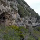
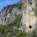
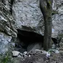
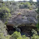
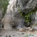
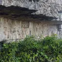
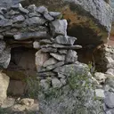
Caves and shafts in Montsià
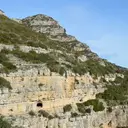
Montsià, at the southern tip of Catalonia, shares the massís dels Ports with Baix Ebre and Terra Alta, one of the country’s most extensive karst systems. The county’s cataloged caves and potholes are concentrated there almost exclusively, in contrast to the Ebre delta plain that dominates the rest of the territory.
101 cavitats (79 coves i 22 avencs) in Montsià have been catalogued, mainly in Ulldecona, Alcanar and la Sénia. Cova Trobada, amb 360 m de recorregut.
The surveyed length of the caves with this data ranges from 3 to 360 metres. The depth ranges from 1 to 99 metres. 3 different rock types are recorded here. You can check the full entry for location, access and, where available, photographs and survey maps. The whole set of caves on this page can also be downloaded as CSV or JSON.
Montsià has an area of 735 km², located mostly in la Serralada Prelitoral. This means an approximate density of 13.7 catalogued caves per 100 km².
Municipalities
Rock Types
- Cova TrobadaInteressant cavitat del Port de gairebé 100 m. de fondària, a la Sénia.
- L'EntronadorImportant surgència de 84 m. de desnivell al barranc de la Fou (el Port).
- Cova UF-2Interessant cavitat de 270 m. de recorregut i 62 m. de fondària al Port (la Sénia).
- Cova del TendoCova d'uns 200 m. de recorregut al Montsià
- Avenc de MaçanaInteressant avenc de 40 m. de fondària i una sala de grans dimensions, al Port.
- Forat TX-2Estreta esquerda d'uns 60 m. de desnivell vora la font del Teix (la Sénia, Montsià)
- Avenc de la Canal de l'AvencMagnífic pou de 63 m. de fondària al Port (Mas de Barberans)
- Avenc dels CastelletsEstret avenc d'uns 52 m. de fondària a Ulldecona (el Montsià)
- Avenc de l'ArionAvenc d'uns 58 m. de fondària a Ulldecona (el Montsià)
- Avenc de les CanalsPetit avenc d'uns 20 m. de fondària a Ulldecona (el Montsià)
- Avenc de la Font del BurgarAvenc de 32 m. de fondària a la zona de la Foradada (Montsià)
- Avenc de la GrallaAvenc de 32 m. de fondària a la Serra de Godall (el Montsià)
- Avenc de la FuraAvenc de 33 m. de fondària a la Serra de Godall.
- Avenc de les SeniolesAvenc constituït per una única sala de notables dimensions, a Ulldecona (el Montsià)
- Cova BonicaPetita cova d'uns 65 m. de recorregut a Ulldecona (el Montsià)
- Cova BonicaLa cova més emblemàtica del massís del Montsià
- Avenc de l'ArboçAvenc d'uns 30 m. de fondària a la Serra de Godall (Montsià)
- Cova de Santa MagdalenaCova a la Serra de Godall (Ulldecona) de 56 m. de recorregut i d'interès arqueològic.
- Avenc de Julio de la SistaBonic avenc de 17 metres de fondària a Ulldecona (Montsià)
- Avenc del Corral del QuixoPetit avenc de 15 m. de fondària al massís del Port (La Sénia)
- Avenc de la Mola de la TorreAvenc de 17 metres de fondària amb una gran boca a Ulldecona.
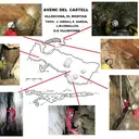
- Avenc del CastellPetit avenc de 14 m. de fondària a Ulldecona
- Avenc dels PlansAvenc de 22 m. de fondària al Port (la Sénia)
- Cova de la SalCuriosa balma amb boca superior a Godall (Montsià)
- Avenc del Camí de les SeniolesPetit avenc a les Senioles, Ulldecona
- Cova de les BruixesPetita cova d'uns 25 m. de recorregut, d'interès arqueològic, a Ulldecona.
- Cova de Sant PauPetita cova semi-artificial a Masdenverge (Montsià)
- Cova del PastorCova inèdita de 25 m de llargada al Montsià
- Cova del PuigPetita cambra subterrània al peu del Puig (Ulldecona)
- Forat de la Faixa de Roca RojaCova de boca de grans dimensions penjada en una paret de la vall del barranc del Regatxol (Mas de Barberans).
- Avenc de Mata-RedonaAvenc sense informació vora les runes de Mata-redona (Montsià)
- Cova de la CantarellaAmagada cova al Montsià (Alcanar)
- Cova del PiPetita, però bonica cova al Montsià
- Cova de la RobaBonica foradada a Mas de Barberans
- Avenc RogerPetit avenc de 8 m. de fondària a Ulldecona (Montsià)
- Forat TX-1Àmplia esquerda d'uns 15 m. de recorregut vora la font del Teix (la Sénia, Montsià)
- Cova del BrutoPetita i gairebé desconeguda cova al vessant NO del Montsià (Freginals)
- Cova dels ÀngelsBonica coveta vora el barranc de la Fou (la Sénia, Montsià)
- Avenc de la ForadadaPetita cavitat dins de la Foradada del Montsià
- Cova Gran de FerranesPetita cova d'uns 15 m. de recorregut al Montsià
- Cova dels Ullals de la CarrovaSurgència a la zona dels Ullals de la Carrova (Amposta)
- Cova CabrideraGran balma al barranc de la Galera (Mas de Barberans)
- Cova del Pare PasqualConeguda balma vora la Torreta del Montsià
- Cova del Racó del MeloPetita cova al Montsià, Alcanar
- Cova de la Punta de la BarquetaPetita, però bonica cova, al NE de la Torreta de Montsià
- Cova del BassiolPetita, però interessant cova al barranc del Bassiol (Montsià)
- Cova CalitraConeguda balma a les Cases d'Alcanar.
- Cova d'en PanísInteressant balma a la Serra de Godall (Montsià)
- Coves de BartomeuConjunt de petites coves i balmes al Montsià (Ulldecona)
- Cova del GallPetita balma al NO de la Torreta del Montsià
- Cova MingolaPetita cova a la Serra de Godall (Montsià)
- Cova d'AndaraGran balma al vessant NO del Montsià (Freginals)
- Cova TerrilPetita cova al vessant SO del Montsià (Ulldecona)
- Cova de la RojaPetita cova al barranc de Cova Roja (la Sénia, Montsià)
- Cova de la CapelletaPetita cova al barranc de la Fou (la Sénia, Montsià)
- Cova PigotosaPetita cova a la zona de Mata-redona (Montsià)
- Cova dels MangotxosPetita cova al barranc de Roca-roja (Ulldecona, Montsià)
- Cova del PalleretPetita cova vora la Foradada del Montsià
- Cova de la TortugaPetita cova vora la Foradada del Montsià
- Cova del PilanetPetita cova a la zona més alta del Montsià
- Cova de la FigueraPetita cova a la part alta del Montsià
- Cova GresolPetita cova a la part alta del Montsià
- Cova del TeixPetita cova a la part alta del Montsià
- Cova del Lligallo de Roca RojaPetita cova a la zona de Roca Roja (el Montsià)
- Cova de la Mola PlanaPetita cova sota la Mola Plana (Montsià)
- Cova del PortellPetita cova vora la Foradada del Montsià
- Cova dels ColomsPetita cova molt concrecionada al Montsià
- Cova del LlopBalma poc important al Montsià
- Cova CanóPetita cova, de boca atractiva, al Montsià
- Cova del Racó del NinyoPetita cova al barranc del Moltó (Alcanar)
- Abrics d'Ermites de la PietatConjunt d'abrics d'interès arqueològic a Ulldecona (Montsià).
- Cova de la CabraGran balma murada a Mas de Barberans
- Forat RoigBalma de grans dimensions a Mas de Barberans
- Avenc del Camí del RòssecPetit avenc d'uns 4 m de fondària vora Godall (Montsià)
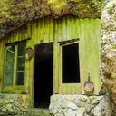
- Cova dels CirersBalma tancada amb paret de fusta a la zona de Vallcaneres (la Sénia)
- Forat de la Pedrera de l'AnticPetita cavitat amb dues saletes a la pedrera de l'Antic (Amposta)
- Cova de la VilaConeguda balma vora la població de Godall (Montsià).
- Abric dels MasetsAllargat abric amb pintures rupestres (Freginals)
- Cova GrossaGran balma paredada al Montsià (Alcanar)
- Cova de l'HedraConeguda balma de poca importància al Montsià
- Cova del FloroBalma poc important a la zona de Mata-redona (Montsià)
- Cova del CastellÍnfima cova vora la Moleta de Fredes (Sant Carles de la Ràpita)
- Cova de la GenetaÍnfima cova al barranc de Mata-redona (Sant Carles de la Ràpita)
- Cova del GrèvolÍnfima cova al barranc de Mata-redona (Sant Carles de la Ràpita)
- Cova dels FranjolsPetita balma al barranc de Solito (la Ràpita)
- Cova dels BousPetita cova per damunt del barranc de la Fou (el Port)
- Cova de les CarrasquesPetita balma a la zona més alta del Montsià
- Cova del ValentPetit abric-aixopluc a la zona de Roca Roja (el Montsià)
- Cova dels LiausBalma corral a Alcanar (Montsià)
- Cova de LaureanoBalma corral a Alcanar (Montsià)
- Cova dels CàntersPetita cova vora lo Palleret (Montsià)
- Cova dels PalmersPetita cova al Montsià
- Coveta del Cocó de VilaroyaPetita cova al Montsià, Alcanar
- Cova del Pou del MeloPetita cova al Montsià, Alcanar
- Cova del MoltóPetita cova al barranc del Moltó (Alcanar)
- Balma del Racó de MetxaModesta balma al vessant SE de la Moleta (Montsià)
- Cova Petita de FerranesPetita cova d'uns 5 m. de recorregut al Montsià
- Cova del Barranc de les TosquesPetita cova a la zona de la Canal Negra del Negrell (la Sénia)
- Cova del BucoPetita cova als cingles del Buco (Montsià)
- Abric de les LlibreresPetit abric amb pintures rupestres a Freginals
- Balma de FerranesModesta balma al Montsià